|
search place name
|
||
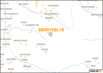
Garrī-ye ‘Olyā (Ostān-e Kohgīlūyeh va Būyer Aḩmad, Iran)Garrī-ye ‘Olyā is a town in the Ostān-e Kohgīlūyeh va Būyer Aḩmad region of Iran. An overview map of the region around Garrī-ye ‘Olyā is displayed below.
regional and 3d topo map of Garrī-ye ‘Olyā, Iran ::
Garrī-ye ‘Olyā airports ::
The nearest airport is MRX - Bandar Mahshahr Mahshahr, located 166.9 km west of Garrī-ye ‘Olyā.
Other airports nearby include BUZ - Bushehr (196.5 km south), QMJ - Masjed Soleiman Shahid Asyaee (209.5 km north west), SYZ - Shiraz Shahid Dastghaib Intl (209.9 km south east), Nearby towns ::
Garrī-ye Soflá (2.0km north west) //
Kalāsghūn (3.7km north west) //
Kābās ‘Alī (4.9km south west) //
Kamar Zard (5.8km south) //
Āb Anār (5.9km north) //
Savārī (6.0km south) //
Pasparī (6.0km south west) //
Talkhāb-e Bālā (7.4km north) //
Sīmūkī (6.6km west) //
Sharāb Gorūh (7.6km north) //
Deh Bar Āftāb (6.9km north west) //
Ārend (7.0km west) //
Deh-e Now (8.1km north west) //
[all distances 'as the bird flies' and approximate] 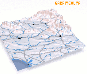 Places with similar names to Garrī-ye ‘Olyā, Iran ::
// Kūreh-ye ‘Olyā (IR)
Disclaimer :: Information on this page comes without warranty of any kind |
||
|
Where is Garrī-ye ‘Olyā? Elevation and coordinates ::
Latitude (lat): 30°43'0"N Longitude (lon): 50°53'0"E
Elevation (approx.): 1729m (map arrows pan, magnifying glasses zoom) |
||
|
Visiting Garrī-ye ‘Olyā? Hotel/Accommodation ::
Book a hotel in Garrī-ye ‘Olyā Travel Guide ::
Buy a travel guide for Iran rental cars ::
car rental offers GPS waypoint ::
download a GPX waypoint (PoI) of Garrī-ye ‘Olyā for your GPS receiver
|
||