|
search place name
|
||
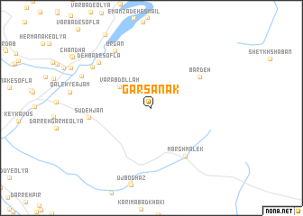
Garsanak (Chahār Maḩāll va Bakhtīār, Iran)Garsanak is a town in the Chahār Maḩāll va Bakhtīār region of Iran. An overview map of the region around Garsanak is displayed below.
regional and 3d topo map of Garsanak, Iran ::
Garsanak airports ::
The nearest airport is QMJ - Masjed Soleiman Shahid Asyaee, located 127.4 km south west of Garsanak.
Other airports nearby include AWZ - Ahwaz (208.9 km south west), MRX - Bandar Mahshahr Mahshahr (252.4 km south west), Nearby towns ::
Var ‘Abdollāh (4.3km north west) //
Bārdeh (6.4km north east) //
Margh Malek (7.0km south east) //
Sūdeh Jān (6.7km west) //
Ūrgān (8.0km north west) //
Deh Bād-e Soflá (7.9km north west) //
Z̧olmābād (8.0km north west) //
Deh Bād-e ‘Olyā (8.3km north west) //
[all distances 'as the bird flies' and approximate] 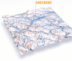 Places with similar names to Garsanak, Iran ::
Disclaimer :: Information on this page comes without warranty of any kind |
||
|
Where is Garsanak? Elevation and coordinates ::
Latitude (lat): 32°32'2"N Longitude (lon): 50°28'9"E
Elevation (approx.): 2427m (map arrows pan, magnifying glasses zoom) |
||
|
Visiting Garsanak? Hotel/Accommodation ::
Book a hotel in Garsanak Travel Guide ::
Buy a travel guide for Iran rental cars ::
car rental offers GPS waypoint ::
download a GPX waypoint (PoI) of Garsanak for your GPS receiver
|
||