|
search place name
|
||
Gaz-e Bālā (Khorāsān, Iran)Gaz-e Bālā is a town in the Khorāsān region of Iran. An overview map of the region around Gaz-e Bālā is displayed below.
regional and 3d topo map of Gaz-e Bālā, Iran ::

Gaz-e Bālā airports ::
The nearest airport is XBJ - Birjand, located 33.3 km north of Gaz-e Bālā.
Nearby towns ::
Gaz (1.3km south) //
Oşghūl (2.3km north west) //
Eskūk (2.8km north east) //
Eskūg Pā'īn (3.3km north east) //
Bīd Meshk (3.4km south east) //
Kalāteh-ye ‘Alī Moḩammad (4.8km north) //
Deh-e Now (4.3km east) //
Mīān Kūh (5.5km north) //
Kalāteh-ye Khodā Bakhsh (5.4km north) //
Chenesht (4.9km north east) //
Mīnā Khūn (5.6km north west) //
Now Kāj (5.9km north west) //
Sang-e Sefīd (6.7km north) //
‘Orbān (6.0km east) //
Nowrashk (8.2km north west) //
Qandāb (7.8km east) //
Kalāteh-ye Moḩammad Sharīf (9.1km north) //
Golestān (9.2km north west) //
Ḩeşār (9.1km north west) //
Pīr Mench (10.3km north west) //
[all distances 'as the bird flies' and approximate] 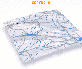 Places with similar names to Gaz-e Bālā, Iran ::
// Casabula (PH)
// Gaisbühl (DE)
// Gaisbühl (DE)
// Gaisbühl (DE)
// Gaisbühl (DE)
// Casa Bella (US)
// Casabella (IT)
// Casa Bullo (IT)
// Cassibile (IT)
// Gåsbøl (NO)
Disclaimer :: Information on this page comes without warranty of any kind |
||
|
Where is Gaz-e Bālā? Elevation and coordinates ::
Latitude (lat): 32°36'27"N Longitude (lon): 59°21'19"E
Elevation (approx.): 1809m (map arrows pan, magnifying glasses zoom) |
||
|
Visiting Gaz-e Bālā? Hotel/Accommodation ::
Book a hotel in Gaz-e Bālā Travel Guide ::
Buy a travel guide for Iran rental cars ::
car rental offers GPS waypoint ::
download a GPX waypoint (PoI) of Gaz-e Bālā for your GPS receiver
|
||