|
search place name
|
||
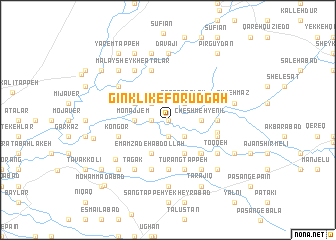
Gīnklīk-e Forūdgāh (Iran)Gīnklīk-e Forūdgāh is a town in Iran. An overview map of the region around Gīnklīk-e Forūdgāh is displayed below.
regional and 3d topo map of Gīnklīk-e Forūdgāh, Iran ::
Nearby towns ::
Chekeh-ye Nīl Shāhpūr (0.0km north) //
Qal‘eh-ye Barbar (0.0km north) //
Qīz Qīz (1.9km south) //
Kangar (1.5km west) //
Qerkh Qez (1.5km west) //
Sāzemān-e Farīd (2.4km south east) //
Barbar Qal‘eh (2.4km north east) //
Sadd-e Chamrān (2.4km north west) //
Cheshmeh-ye Nīl (2.9km east) //
Monajjem (2.9km west) //
Bāynāl (4.0km south) //
Emāmzādeh ‘Abdollāh (4.0km south) //
Hemmatābād-e Sīstānīhā (3.5km north west) //
Āchār (4.7km south east) //
Towḩīd (4.7km south east) //
Ḩeydarābād (5.6km south) //
Āydarvīsh (4.4km east) //
Kalāleh (4.6km east) //
Darvīsh (4.8km south east) //
Kūseh (4.8km south east) //
Kongor (4.8km south west) //
Tūrang Tappeh (5.8km south) //
Bārānī (5.8km south) //
Mameshlī (5.8km south) //
Qareh Şaḩneh (5.8km north) //
Toqqeh (5.8km south east) //
Gīlānshāh (6.3km south east) //
Tagak (6.3km south west) //
‘Arab Būrān (6.3km south west) //
[all distances 'as the bird flies' and approximate] 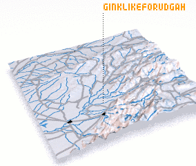 Places with similar names to Gīnklīk-e Forūdgāh, Iran :: Disclaimer :: Information on this page comes without warranty of any kind |
||
|
Where is Gīnklīk-e Forūdgāh? Elevation and coordinates ::
Latitude (lat): 37°23'0"N Longitude (lon): 55°27'0"E
Elevation (approx.): 121m (map arrows pan, magnifying glasses zoom) |
||
|
Visiting Gīnklīk-e Forūdgāh? Hotel/Accommodation ::
Book a hotel in Gīnklīk-e Forūdgāh Travel Guide ::
Buy a travel guide for Iran rental cars ::
car rental offers GPS waypoint ::
download a GPX waypoint (PoI) of Gīnklīk-e Forūdgāh for your GPS receiver
|
||