|
search place name
|
||
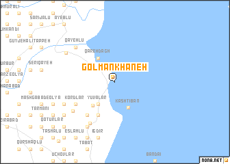
Golmānkhāneh (Ostān-e Āz̄arbāyjān-e Sharqī, Iran)Golmānkhāneh is a town in the Ostān-e Āz̄arbāyjān-e Sharqī region of Iran. An overview map of the region around Golmānkhāneh is displayed below.
regional and 3d topo map of Golmānkhāneh, Iran ::
Golmānkhāneh airports ::
The nearest airport is TBZ - Tabriz Intl, located 103.3 km north east of Golmānkhāneh.
Other airports nearby include VAN - Van (195.9 km north west), Nearby towns ::
Yūvālār (4.2km south west) //
Qareh Dāgh (4.4km north west) //
Kashtībān (4.6km south) //
Mīāvaq (4.8km south west) //
Bālderlū (5.8km south) //
Ḩeşār-e Ḩājjīlār (5.8km south) //
Qeshlāq-e Mīrzā‘alī (5.8km south) //
Qeshlāq-e Moḩammad Qolī (5.8km south) //
Yengejeh (6.5km south west) //
Dīzaj-e Naqāleh (6.5km south west) //
Kordlar (6.2km south west) //
Emāmzādeh (7.5km south west) //
Kordlar (7.3km south west) //
Qayehlū (7.6km north west) //
Qarājalū (8.1km south west) //
‘Īsákān (8.1km south west) //
Dārghālū (7.5km south west) //
Posht-e Gol (7.5km south west) //
Qahremānlū-ye ‘Olyā (7.9km north west) //
Haspestān (8.5km south west) //
Ḩājjī Pīrlū (9.8km south west) //
Āydenlū (9.8km south west) //
[all distances 'as the bird flies' and approximate]  Places with similar names to Golmānkhāneh, Iran :: Disclaimer :: Information on this page comes without warranty of any kind |
||
|
Where is Golmānkhāneh? Elevation and coordinates ::
Latitude (lat): 37°35'56"N Longitude (lon): 45°16'28"E
Elevation (approx.): 1267m (map arrows pan, magnifying glasses zoom) |
||
|
Visiting Golmānkhāneh? Hotel/Accommodation ::
Book a hotel in Golmānkhāneh Travel Guide ::
Buy a travel guide for Iran rental cars ::
car rental offers GPS waypoint ::
download a GPX waypoint (PoI) of Golmānkhāneh for your GPS receiver
|
||