|
search place name
|
||
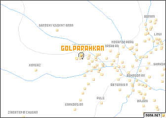
Gol Parahkān (Hormozgān, Iran)Gol Parahkān is a town in the Hormozgān region of Iran. An overview map of the region around Gol Parahkān is displayed below.
regional and 3d topo map of Gol Parahkān, Iran ::
Gol Parahkān airports ::
The nearest airport is BND - Bandar Abbass Intl, located 97.6 km south west of Gol Parahkān.
Other airports nearby include KHS - Khasab (199.8 km south west), Nearby towns ::
Sang Band (0.5km west) //
Por Gazī (1.0km east) //
Korgazī (1.2km west) //
Kalītū (1.4km west) //
Chāh Nūrī (1.5km north east) //
Chīl Banān (1.6km south east) //
Kal Qarābād (1.8km north) //
Sargost-e Bālā (1.9km east) //
Qalamān (2.6km east) //
Kam Kordān (2.9km south) //
Sarkahnān (2.6km east) //
Jannatābād (2.8km south east) //
Razū'īyeh (3.1km south east) //
Deh Now (3.0km south east) //
Sarzeh (2.9km east) //
Pākam-e Bālā (3.0km east) //
Ebrāhīm ‘Alī (3.1km south east) //
Chīlakī (3.8km south) //
Pākam-e Pā'īn (3.5km east) //
Qal‘eh Dezh (3.5km east) //
Nūrābād (4.0km south east) //
Māshangī (4.1km south east) //
Charmīān (4.2km south east) //
Sargost-e Pā'īn (4.1km east) //
Kondar (4.2km east) //
Konār Dang (5.1km south east) //
Ḩājjīābād (4.6km east) //
Deh-e Parangān (5.1km south east) //
Gaz Sheykhī (5.2km south east) //
[all distances 'as the bird flies' and approximate]  Places with similar names to Gol Parahkān, Iran ::
Disclaimer :: Information on this page comes without warranty of any kind |
||
|
Where is Gol Parahkān? Elevation and coordinates ::
Latitude (lat): 27°47'22"N Longitude (lon): 57°7'45"E
Elevation (approx.): 503m (map arrows pan, magnifying glasses zoom) |
||
|
Visiting Gol Parahkān? Hotel/Accommodation ::
Book a hotel in Gol Parahkān Travel Guide ::
Buy a travel guide for Iran rental cars ::
car rental offers GPS waypoint ::
download a GPX waypoint (PoI) of Gol Parahkān for your GPS receiver
|
||