|
search place name
|
||
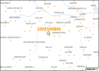
Gomeshābād (Kermān, Iran)Gomeshābād is a town in the Kermān region of Iran. An overview map of the region around Gomeshābād is displayed below.
regional and 3d topo map of Gomeshābād, Iran ::
Gomeshābād airports ::
The nearest airport is TBZ - Tabriz Intl, located 64.5 km south west of Gomeshābād.
Nearby towns ::
Gamshābād (1.9km north) //
Khorramābād (1.5km east) //
Zanjīr Bolāgh (2.4km north west) //
Ebrāhīm Kandī (2.9km east) //
Yāyjīlū (3.7km north) //
Ţaraf (5.6km south) //
Valīlū (5.6km south) //
Gūy Daraq-e Tāzeh Kand (5.7km south west) //
Dāylār (6.3km north west) //
Bareh Yūsofān (5.7km north east) //
Qezeljeh (6.3km north west) //
Dāmanābād (6.1km west) //
Mazra‘eh-ye Ḩājjī ‘Ābedīn (6.1km east) //
Gavanjīk (7.6km north) //
Gūnjīk (7.6km north) //
Qareh Gūnī (8.0km south) //
Ūshdelaq (8.0km north) //
Asb Khān (8.0km south east) //
Āqā ‘Alīlū (8.0km south west) //
Mollālār-e Moḩammnadreẕā Kandī (8.0km north west) //
Moḩammad Reẕā Kandī (8.0km north west) //
Naşīrkhān Tappehsī (8.0km north east) //
Estjān (9.4km south east) //
[all distances 'as the bird flies' and approximate] 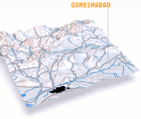 Places with similar names to Gomeshābād, Iran ::
Disclaimer :: Information on this page comes without warranty of any kind |
||
|
Where is Gomeshābād? Elevation and coordinates ::
Latitude (lat): 38°23'0"N Longitude (lon): 46°54'0"E
Elevation (approx.): 2075m (map arrows pan, magnifying glasses zoom) |
||
|
Visiting Gomeshābād? Hotel/Accommodation ::
Book a hotel in Gomeshābād Travel Guide ::
Buy a travel guide for Iran rental cars ::
car rental offers GPS waypoint ::
download a GPX waypoint (PoI) of Gomeshābād for your GPS receiver
|
||