|
search place name
|
||
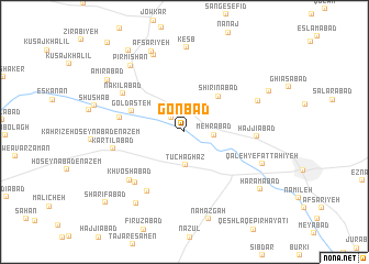
Gonbad (Hamadān, Iran)Gonbad is a town in the Hamadān region of Iran. An overview map of the region around Gonbad is displayed below.
regional and 3d topo map of Gonbad, Iran ::
Gonbad airports ::
The nearest airport is KSH - Bakhtaran Shahid Ashrafi Esfahani, located 143.0 km west of Gonbad.
Other airports nearby include SDG - Sanandaj (186.0 km north west), Nearby towns ::
Karkān (1.8km north west) //
Mehrābād (2.5km east) //
Tūchaghāz (3.4km south) //
Shīrīnābād (4.6km north east) //
Goldasteh (4.9km north west) //
Qal‘eh-ye Kartīlābād (5.6km west) //
Nāşeḩābād (6.8km south west) //
Khosrowābād (6.6km south west) //
Ḩājjīābād (6.1km east) //
Nakīlābād (6.5km north west) //
Khvoshābād (6.7km south west) //
Kartīlābād (6.2km west) //
Yūnjī (6.9km north east) //
Golshīr (8.3km north) //
Kesb (8.6km north) //
Qal`eh-ye Fattāḩīyeh (7.4km south east) //
Pīr Mīshān (8.1km north west) //
Bahmanābād (8.3km south west) //
Afsarīyeh (8.6km north) //
Namāz Gāh (9.1km south) //
Amīrābād (8.3km north west) //
Golūshjerd (8.2km north east) //
Ḩaramābād (8.6km south east) //
Mobārakābād (9.4km north west) //
Sharīfābād (9.8km south west) //
[all distances 'as the bird flies' and approximate] 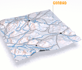 Places with similar names to Gonbad, Iran ::
Disclaimer :: Information on this page comes without warranty of any kind |
||
|
Where is Gonbad? Elevation and coordinates ::
Latitude (lat): 34°19'46"N Longitude (lon): 48°42'42"E
Elevation (approx.): 1697m (map arrows pan, magnifying glasses zoom) |
||
|
Visiting Gonbad? Hotel/Accommodation ::
Book a hotel in Gonbad Travel Guide ::
Buy a travel guide for Iran rental cars ::
car rental offers GPS waypoint ::
download a GPX waypoint (PoI) of Gonbad for your GPS receiver
|
||