|
search place name
|
||
Gonbadak (Khorāsān, Iran)Gonbadak is a town in the Khorāsān region of Iran. An overview map of the region around Gonbadak is displayed below.
regional and 3d topo map of Gonbadak, Iran ::
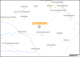
Nearby towns ::
Gondeh Cheshmeh (2.9km south east) //
Kārīz-e Moḩammad Jān (3.3km south) //
Sefīd Sang (7.1km west) //
‘Arabābād (7.6km north west) //
Ebrāhīmbāy (9.7km south east) //
Kalāteh-ye Ţabaq Sar (9.7km north west) //
Senjedak-e Kārghash (10.3km north east) //
Pāchan Kalāgh (10.6km north west) //
[all distances 'as the bird flies' and approximate]  Places with similar names to Gonbadak, Iran ::
// Canbadoc (PH)
// Kānī Bōtik (IQ)
// Ganbatak (IR)
// Gonbadak (IR)
// Gonbatūk (IR)
// Gonbadak (AF)
// Konbé Tiko (CM)
// Gonbodougou (CI)
Disclaimer :: Information on this page comes without warranty of any kind |
||
|
Where is Gonbadak? Elevation and coordinates ::
Latitude (lat): 35°40'39"N Longitude (lon): 60°10'5"E
Elevation (approx.): 1351m (map arrows pan, magnifying glasses zoom) |
||
|
Visiting Gonbadak? Hotel/Accommodation ::
Book a hotel in Gonbadak Travel Guide ::
Buy a travel guide for Iran rental cars ::
car rental offers GPS waypoint ::
download a GPX waypoint (PoI) of Gonbadak for your GPS receiver
|
||