|
search place name
|
||
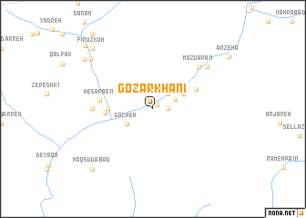
Goz̄ar Khānī (Tehrān, Iran)Goz̄ar Khānī is a town in the Tehrān region of Iran. An overview map of the region around Goz̄ar Khānī is displayed below.
regional and 3d topo map of Goz̄ar Khānī, Iran ::
Goz̄ar Khānī airports ::
The nearest airport is THR - Teheran Mehrabad Intl, located 113.4 km west of Goz̄ar Khānī.
Other airports nearby include RZR - Ramsar (227.2 km north west), Nearby towns ::
Dar Ḩeşār (0.7km north east) //
Māyān (1.5km east) //
Talī Jāreh (2.4km north east) //
Gāv Darreh (2.5km north east) //
Gacheh (3.1km south west) //
Daryā Beyg (3.5km north east) //
Ḩoseynābād (4.5km west) //
Deh Gardān (5.0km north east) //
Mavīn (4.8km west) //
Ḩeşār Bon (5.4km west) //
Movīn (6.0km west) //
Ḩasanābād-e Bālā (6.0km west) //
Mozdārān (6.9km north east) //
Ātashān (7.5km north east) //
Sorkheh (8.8km north west) //
Chaman (9.2km north west) //
Maqşūdābād (9.6km south west) //
Fīrūz Kūh (9.6km north west) //
Mashhad (10.3km north west) //
[all distances 'as the bird flies' and approximate] 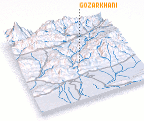 Places with similar names to Goz̄ar Khānī, Iran ::
Disclaimer :: Information on this page comes without warranty of any kind |
||
|
Where is Goz̄ar Khānī? Elevation and coordinates ::
Latitude (lat): 35°32'0"N Longitude (lon): 52°33'0"E
Elevation (approx.): 1501m (map arrows pan, magnifying glasses zoom) |
||
|
Visiting Goz̄ar Khānī? Hotel/Accommodation ::
Book a hotel in Goz̄ar Khānī Travel Guide ::
Buy a travel guide for Iran rental cars ::
car rental offers GPS waypoint ::
download a GPX waypoint (PoI) of Goz̄ar Khānī for your GPS receiver
|
||