|
search place name
|
||
Gūd-e Amīr (Fārs, Iran)Gūd-e Amīr is a town in the Fārs region of Iran. An overview map of the region around Gūd-e Amīr is displayed below.
regional and 3d topo map of Gūd-e Amīr, Iran ::

Gūd-e Amīr airports ::
The nearest airport is SYZ - Shiraz Shahid Dastghaib Intl, located 124.4 km south east of Gūd-e Amīr.
Other airports nearby include BUZ - Bushehr (178.7 km south west), Nearby towns ::
Menūn (2.9km south) //
Sar Bon-e Reẕā (2.7km south west) //
Delī Ra'īs (3.4km south) //
Seyyed Moḩammad (3.2km south west) //
Tall Belekī (5.5km north west) //
Nārak (6.0km south west) //
Nūshk (6.9km south) //
Pasakī (8.0km south) //
Darreh Māhīnī (7.7km north east) //
Bard Zard (7.3km east) //
Namāzgāh (7.3km west) //
Jowzār-e Jāvīd (8.4km south) //
Pīr Ashkaft (7.8km west) //
Moleh Shīrī (8.9km north west) //
Tang-e Khoshk (9.4km north east) //
Cheshmeh Chenār (9.6km north east) //
Tang-e Moshkān (9.8km north east) //
Jowzār-e Bakesh (10.9km south west) //
[all distances 'as the bird flies' and approximate] 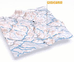 Places with similar names to Gūd-e Amīr, Iran ::
Disclaimer :: Information on this page comes without warranty of any kind |
||
|
Where is Gūd-e Amīr? Elevation and coordinates ::
Latitude (lat): 30°21'44"N Longitude (lon): 51°42'48"E
Elevation (approx.): 2646m (map arrows pan, magnifying glasses zoom) |
||
|
Visiting Gūd-e Amīr? Hotel/Accommodation ::
Book a hotel in Gūd-e Amīr Travel Guide ::
Buy a travel guide for Iran rental cars ::
car rental offers GPS waypoint ::
download a GPX waypoint (PoI) of Gūd-e Amīr for your GPS receiver
|
||