|
search place name
|
||
Gūlbandī-ye Soflá (Lorestān, Iran)Gūlbandī-ye Soflá is a town in the Lorestān region of Iran. An overview map of the region around Gūlbandī-ye Soflá is displayed below.
regional and 3d topo map of Gūlbandī-ye Soflá, Iran ::

Gūlbandī-ye Soflá airports ::
The nearest airport is KSH - Bakhtaran Shahid Ashrafi Esfahani, located 92.2 km north of Gūlbandī-ye Soflá.
Other airports nearby include SDG - Sanandaj (190.0 km north), Nearby towns ::
Gūlbandī-ye ‘Olyā (0.0km north) //
Sar Bīsheh (1.5km west) //
Pacheh Sorkheh (2.4km south east) //
Chāh Qāsemī (2.4km north west) //
Sargel-e Farkhīvand (3.7km south) //
Eslāmābād (3.6km north west) //
Chākaram Khān (5.0km east) //
Atābakī (5.0km east) //
Kharbozah Dūl (5.8km north) //
Sar Gandāb (5.9km south west) //
Seh Gandāb (5.9km south west) //
Kūseh (7.6km south) //
Cham-e Dār Balūţ (7.6km south) //
Cham-e Mīr Beyg (7.6km south) //
Sīāh Kamar-e Zālī (6.5km west) //
Cham Jangal (6.5km west) //
Kalok (7.6km north) //
Kūl Bādām-e Nūrmorād (7.2km north east) //
Kūl Bādām-e Yāvar (7.2km north east) //
Kamūl-e Bābā Khānī (8.0km north east) //
Qāzī Khānī (8.3km south west) //
Chokhā Sabz (8.7km south east) //
Bārīkeh-ye As̄arzamīn (8.7km south west) //
Kamūl-e Rostam Beygī (8.7km north east) //
Kamūl-e Karam Khānī (8.7km north east) //
Āb Zād (9.7km south west) //
[all distances 'as the bird flies' and approximate] 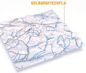 Places with similar names to Gūlbandī-ye Soflá, Iran :: Disclaimer :: Information on this page comes without warranty of any kind |
||
|
Where is Gūlbandī-ye Soflá? Elevation and coordinates ::
Latitude (lat): 33°32'0"N Longitude (lon): 46°57'0"E
Elevation (approx.): 1194m (map arrows pan, magnifying glasses zoom) |
||
|
Visiting Gūlbandī-ye Soflá? Hotel/Accommodation ::
Book a hotel in Gūlbandī-ye Soflá Travel Guide ::
Buy a travel guide for Iran rental cars ::
car rental offers GPS waypoint ::
download a GPX waypoint (PoI) of Gūlbandī-ye Soflá for your GPS receiver
|
||