|
search place name
|
||
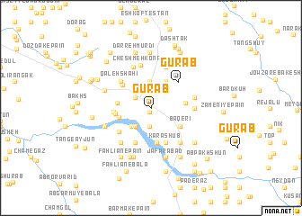
Gūrāb (Fārs, Iran)Gūrāb is a town in the Fārs region of Iran. An overview map of the region around Gūrāb is displayed below.
regional and 3d topo map of Gūrāb, Iran ::
Gūrāb airports ::
The nearest airport is SYZ - Shiraz Shahid Dastghaib Intl, located 131.7 km south east of Gūrāb.
Other airports nearby include BUZ - Bushehr (158.9 km south west), Nearby towns ::
Kūshgak-e Pā'īn (0.5km south) //
Bīd Gerd (0.5km south) //
Kūshgak-e Bālā (0.5km south) //
Tol-e Pīr (1.3km north) //
Bābā Meydān-e Pā'īn (2.1km north west) //
Dowlatābād-e Bālā (2.4km south) //
Bāgūrīn (2.5km north east) //
Dowlatābād-e Pā'īn (2.9km south west) //
Bāqerī (3.2km north) //
Bābā Gūrīn (3.2km north) //
Davāzdahī (3.1km south west) //
Do Dar (3.5km north east) //
Mīāneh (3.6km west) //
Tal-e Afghānī (3.7km west) //
Ḩājjī Kachal (3.7km east) //
Bāqerī (3.9km south east) //
Tal-e Sefīd (3.8km west) //
Gar-e Āshūb (4.4km south) //
Tal-e Gar (4.1km north west) //
Seh Talān (3.9km west) //
Karāshūb (4.5km south) //
Tall Bīsheh (4.6km south) //
Gūrāb (4.4km north east) //
Servān (4.5km south west) //
Qal‘eh Shāhī (4.6km north west) //
Gar Qāsem (4.6km north west) //
Zeytūn (5.3km north) //
Paskahak (5.3km north) //
Maşīrī (4.6km east) //
[all distances 'as the bird flies' and approximate] 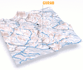 Places with similar names to Gūrāb, Iran ::
Disclaimer :: Information on this page comes without warranty of any kind |
||
|
Where is Gūrāb? Elevation and coordinates ::
Latitude (lat): 30°15'17"N Longitude (lon): 51°30'3"E
Elevation (approx.): 858m (map arrows pan, magnifying glasses zoom) |
||
|
Visiting Gūrāb? Hotel/Accommodation ::
Book a hotel in Gūrāb Travel Guide ::
Buy a travel guide for Iran rental cars ::
car rental offers GPS waypoint ::
download a GPX waypoint (PoI) of Gūrāb for your GPS receiver
|
||