|
search place name
|
||
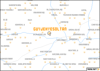
Gūyjeh-ye Solţān (Ostān-e Āz̄arbāyjān-e Sharqī, Iran)Gūyjeh-ye Solţān is a town in the Ostān-e Āz̄arbāyjān-e Sharqī region of Iran. An overview map of the region around Gūyjeh-ye Solţān is displayed below.
regional and 3d topo map of Gūyjeh-ye Solţān, Iran ::
Gūyjeh-ye Solţān airports ::
The nearest airport is TBZ - Tabriz Intl, located 55.6 km south west of Gūyjeh-ye Solţān.
Nearby towns ::
‘Alavīq (1.1km north) //
Kāsīn (2.5km north west) //
Dīzaj-e Malek (3.0km west) //
Varzaqān (4.6km south east) //
Āreh Jān (4.4km west) //
Dūrīq (5.6km north east) //
Lalehlū (5.1km south east) //
Karavīq (5.9km north east) //
Yāshīl (6.8km north) //
Kheyr od Dīn (7.3km south) //
Dīzaj-e Şafar ‘Alī (5.8km east) //
Ravārānaq (8.1km north) //
Qarājeh Malek (8.5km north) //
Ālcheh Qeshlāq (8.6km north) //
Rūzī (7.5km north west) //
Chāy Kandī-ye Kheyr ed Dīn (8.4km south west) //
Mīrzā ‘Alī Kandī (8.7km south) //
Leylī Khāneh (9.0km north) //
Ḩammāmlū (7.9km south west) //
Qareh Bolāgh (8.3km south west) //
Bekrābād (8.8km north east) //
Qayeh Qeshlāq (9.5km north east) //
Mehtarlū (9.7km south east) //
[all distances 'as the bird flies' and approximate] 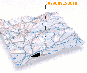 Places with similar names to Gūyjeh-ye Solţān, Iran :: Disclaimer :: Information on this page comes without warranty of any kind |
||
|
Where is Gūyjeh-ye Solţān? Elevation and coordinates ::
Latitude (lat): 38°31'25"N Longitude (lon): 46°38'1"E
Elevation (approx.): 1671m (map arrows pan, magnifying glasses zoom) |
||
|
Visiting Gūyjeh-ye Solţān? Hotel/Accommodation ::
Book a hotel in Gūyjeh-ye Solţān Travel Guide ::
Buy a travel guide for Iran rental cars ::
car rental offers GPS waypoint ::
download a GPX waypoint (PoI) of Gūyjeh-ye Solţān for your GPS receiver
|
||