|
search place name
|
||
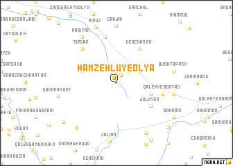
Ḩamzehlū-ye ‘Olyā (Hamadān, Iran)Ḩamzehlū-ye ‘Olyā is a town in the Hamadān region of Iran. An overview map of the region around Ḩamzehlū-ye ‘Olyā is displayed below.
regional and 3d topo map of Ḩamzehlū-ye ‘Olyā, Iran ::
Ḩamzehlū-ye ‘Olyā airports ::
The nearest airport is KSH - Bakhtaran Shahid Ashrafi Esfahani, located 180.5 km west of Ḩamzehlū-ye ‘Olyā.
Nearby towns ::
Bīghash (1.4km north east) //
Ḩamzehlū-ye Soflá (1.9km north) //
Cheshmeh Zowraq (2.4km north east) //
Qāsemābād (3.6km north east) //
Cheshmeh-ye ‘Alī Moḩammad (3.6km north east) //
Āq Bolāgh (5.0km east) //
Sang Deh (5.0km west) //
Jalāyer (5.9km south east) //
Deh Chāneh (6.4km north east) //
Qal‘eh Now (7.6km north) //
Qal‘eh-ye Bonyād (6.4km east) //
Mūsīrābād (7.2km north west) //
Sīrdar (7.2km north west) //
Parīyān (8.7km north west) //
Qal‘ehchī-ye Soflá (9.0km south east) //
Tappeh-ye Mowlā (9.0km south west) //
Darreh-ye Morād (9.5km south west) //
Mazra‘eh-ye Khātūn (9.9km south east) //
[all distances 'as the bird flies' and approximate]  Places with similar names to Ḩamzehlū-ye ‘Olyā, Iran :: Disclaimer :: Information on this page comes without warranty of any kind |
||
|
Where is Ḩamzehlū-ye ‘Olyā? Elevation and coordinates ::
Latitude (lat): 34°3'0"N Longitude (lon): 49°5'0"E
Elevation (approx.): 2160m (map arrows pan, magnifying glasses zoom) |
||
|
Visiting Ḩamzehlū-ye ‘Olyā? Hotel/Accommodation ::
Book a hotel in Ḩamzehlū-ye ‘Olyā Travel Guide ::
Buy a travel guide for Iran rental cars ::
car rental offers GPS waypoint ::
download a GPX waypoint (PoI) of Ḩamzehlū-ye ‘Olyā for your GPS receiver
|
||