|
search place name
|
||
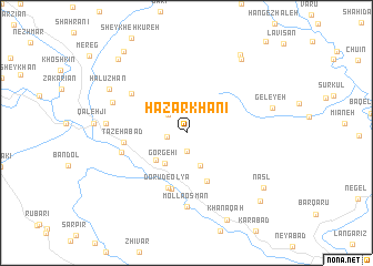
Hazār Khānī (Kordestān, Iran)Hazār Khānī is a town in the Kordestān region of Iran. An overview map of the region around Hazār Khānī is displayed below.
regional and 3d topo map of Hazār Khānī, Iran ::
Hazār Khānī airports ::
The nearest airport is SDG - Sanandaj, located 59.6 km east of Hazār Khānī.
Other airports nearby include KSH - Bakhtaran Shahid Ashrafi Esfahani (132.8 km south east), Nearby towns ::
Takhān (1.9km south) //
Sefīdār (1.6km west) //
Anjomneh (2.4km north west) //
Sarvābād (3.5km south) //
Gorgeh'ī (3.6km south west) //
Aḩmadābād (3.7km south west) //
Tarkhānābād (5.1km south) //
Dorūd-e Soflá (5.8km south) //
Dorūd-e ‘Olyā (5.8km south) //
Sar Khāneqāh (5.8km south) //
Maḩmūdābād-e Sheykh ‘Os̄mān (5.8km south) //
Tāzehābād (5.3km west) //
Teflī (5.7km west) //
Ālmāneh (6.0km north west) //
Mollā ‘Os̄mān (7.4km south) //
Gelāneh (6.8km north west) //
Qal‘eh Gāh (6.7km west) //
Hālūzhān (7.7km north west) //
Geleyeh (7.5km east) //
Māmūleh (8.7km north east) //
Belcheh Sūr (9.0km north east) //
Nasl (8.4km south east) //
Khānaqāh (9.3km south) //
Gūshkhānī (9.1km south east) //
Naneh (9.3km north west) //
Chūr (9.6km north west) //
[all distances 'as the bird flies' and approximate]  Places with similar names to Hazār Khānī, Iran ::
// Ḩeşār-e Khūnī (IR)
// Hezār Khān (IR)
// Hezār Khānī (IR)
// Hezār Khānī (IR)
// Hezār Khānī (IR)
// Hazār Khān (PK)
Disclaimer :: Information on this page comes without warranty of any kind |
||
|
Where is Hazār Khānī? Elevation and coordinates ::
Latitude (lat): 35°21'0"N Longitude (lon): 46°22'0"E
Elevation (approx.): 1755m (map arrows pan, magnifying glasses zoom) |
||
|
Visiting Hazār Khānī? Hotel/Accommodation ::
Book a hotel in Hazār Khānī Travel Guide ::
Buy a travel guide for Iran rental cars ::
car rental offers GPS waypoint ::
download a GPX waypoint (PoI) of Hazār Khānī for your GPS receiver
|
||