|
search place name
|
||
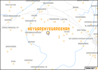
Ḩeydareh-ye Dār-e Emām (Hamadān, Iran)Ḩeydareh-ye Dār-e Emām is a town in the Hamadān region of Iran. An overview map of the region around Ḩeydareh-ye Dār-e Emām is displayed below.
regional and 3d topo map of Ḩeydareh-ye Dār-e Emām, Iran ::
Ḩeydareh-ye Dār-e Emām airports ::
The nearest airport is KSH - Bakhtaran Shahid Ashrafi Esfahani, located 121.3 km south west of Ḩeydareh-ye Dār-e Emām.
Other airports nearby include SDG - Sanandaj (131.1 km west), Nearby towns ::
Gūshalān (2.7km north west) //
Barf-e Jīn (3.1km east) //
Vafr-e Jīn (3.3km east) //
Fesījān (4.1km north west) //
Robāţ-e Za‘farānī (5.3km north) //
Ya‘qūb Shāh (5.4km north) //
Ḩoseynābād-e Bahār (5.4km north) //
Hūʼī Jīn (4.6km east) //
Zāgheh (5.8km north) //
Nūrābād-e Sīmīneh (5.0km west) //
Daftarchīn (5.2km south east) //
Sīmīn-e Zāgheh (6.5km north) //
Tūʼī Jīn (5.6km east) //
Vahnān (6.5km south west) //
Chāyān (6.9km north east) //
Sang-e Sefīd (7.3km north west) //
Ḩeşār Qareh Bāghī (7.1km west) //
Ravān (8.0km north west) //
Cheshmeh Qaşşābān (7.5km north east) //
Tāzeh Kand (9.3km north) //
[all distances 'as the bird flies' and approximate] 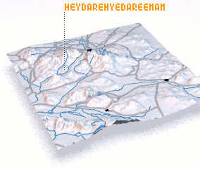 Places with similar names to Ḩeydareh-ye Dār-e Emām, Iran :: Disclaimer :: Information on this page comes without warranty of any kind |
||
|
Where is Ḩeydareh-ye Dār-e Emām? Elevation and coordinates ::
Latitude (lat): 34°49'14"N Longitude (lon): 48°20'57"E
Elevation (approx.): 2312m (map arrows pan, magnifying glasses zoom) |
||
|
Visiting Ḩeydareh-ye Dār-e Emām? Hotel/Accommodation ::
Book a hotel in Ḩeydareh-ye Dār-e Emām Travel Guide ::
Buy a travel guide for Iran rental cars ::
car rental offers GPS waypoint ::
download a GPX waypoint (PoI) of Ḩeydareh-ye Dār-e Emām for your GPS receiver
|
||