|
search place name
|
||
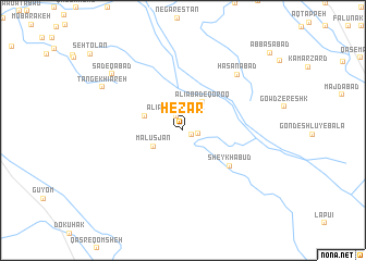
Hezār (Fārs, Iran)Hezār is a town in the Fārs region of Iran. An overview map of the region around Hezār is displayed below.
regional and 3d topo map of Hezār, Iran ::
Hezār airports ::
The nearest airport is SYZ - Shiraz Shahid Dastghaib Intl, located 39.1 km south of Hezār.
Other airports nearby include BUZ - Bushehr (193.9 km south west), Nearby towns ::
Kūshk-e Hezār (0.9km south east) //
‘Alīābād-e Sar Tol (1.6km north west) //
Kūshk-e Hazār (1.4km east) //
Malūs Jān (3.1km south west) //
‘Alīābād-e Qoroq (3.4km north east) //
Jārīābād (3.7km north west) //
Sheykh ‘Abūd (5.6km south east) //
Ḩasanābād (7.5km north east) //
Şādeqābād (8.5km north west) //
Tang-e Khīāreh (8.4km north west) //
[all distances 'as the bird flies' and approximate]  Places with similar names to Hezār, Iran ::
Disclaimer :: Information on this page comes without warranty of any kind |
||
|
Where is Hezār? Elevation and coordinates ::
Latitude (lat): 29°53'12"N Longitude (lon): 52°31'8"E
Elevation (approx.): 1628m (map arrows pan, magnifying glasses zoom) |
||
|
Visiting Hezār? Hotel/Accommodation ::
Book a hotel in Hezār Travel Guide ::
Buy a travel guide for Iran rental cars ::
car rental offers GPS waypoint ::
download a GPX waypoint (PoI) of Hezār for your GPS receiver
|
||