|
search place name
|
||
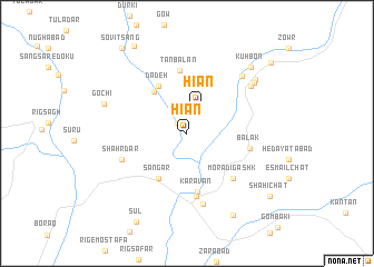
Hīān (Sīstān va Balūchestān, Iran)Hīān is a town in the Sīstān va Balūchestān region of Iran. An overview map of the region around Hīān is displayed below.
regional and 3d topo map of Hīān, Iran ::
Hīān airports ::
The nearest airport is ZBR - Chah Bahar, located 109.7 km east of Hīān.
Nearby towns ::
Bandgāh (1.4km north west) //
Hīān (2.9km north) //
Garagān (5.1km north west) //
Sangar (5.1km south west) //
Dādeh (5.4km north west) //
Kāravān (5.9km south) //
Tanbalān (6.3km north) //
Dodar (6.4km south) //
Morādī Gashk (6.1km south east) //
Balak (5.9km east) //
Shahr Dar (6.4km south west) //
Lāsh (7.3km south) //
Karījānī (7.6km north east) //
Gamarānī (7.5km north east) //
Kū Āmzānī (7.9km north east) //
Bamzānī (8.2km north east) //
Gochī (8.1km west) //
Kūhbon (8.8km north east) //
Shahsavīrī Bāzār (9.2km south east) //
Sūl (10.0km south west) //
Kalīrī (10.0km north west) //
Shāhī Chāt (9.8km south east) //
Sovīt Sang (10.3km north west) //
Dampk (10.4km north east) //
[all distances 'as the bird flies' and approximate] 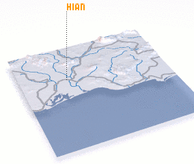 Places with similar names to Hīān, Iran ::
Disclaimer :: Information on this page comes without warranty of any kind |
||
|
Where is Hīān? Elevation and coordinates ::
Latitude (lat): 25°41'25"N Longitude (lon): 59°19'31"E
Elevation (approx.): 20m (map arrows pan, magnifying glasses zoom) |
||
|
Visiting Hīān? Hotel/Accommodation ::
Book a hotel in Hīān Travel Guide ::
Buy a travel guide for Iran rental cars ::
car rental offers GPS waypoint ::
download a GPX waypoint (PoI) of Hīān for your GPS receiver
|
||