|
search place name
|
||
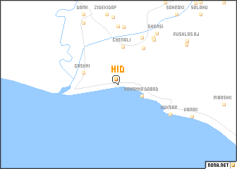
Hīd (Hormozgān, Iran)Hīd is a town in the Hormozgān region of Iran. An overview map of the region around Hīd is displayed below.
regional and 3d topo map of Hīd, Iran ::
Hīd airports ::
The nearest airport is ZBR - Chah Bahar, located 163.1 km east of Hīd.
Other airports nearby include MCT - Muscat Seeb Intl (225.8 km south), Nearby towns ::
Moḩammadābād (3.8km south east) //
Gashmī (5.3km west) //
Chenālī (6.0km north) //
Gowhert (6.7km north east) //
Chīl (8.1km north east) //
Barākaʼī (8.7km north east) //
Raḩīm Mach (8.9km north east) //
Kūksar (8.7km south east) //
Shemsī (9.8km north east) //
[all distances 'as the bird flies' and approximate]  Places with similar names to Hīd, Iran ::
Disclaimer :: Information on this page comes without warranty of any kind |
||
|
Where is Hīd? Elevation and coordinates ::
Latitude (lat): 25°35'0"N Longitude (lon): 58°46'0"E
Elevation (approx.): 7m (map arrows pan, magnifying glasses zoom) |
||
|
Visiting Hīd? Hotel/Accommodation ::
Book a hotel in Hīd Travel Guide ::
Buy a travel guide for Iran rental cars ::
car rental offers GPS waypoint ::
download a GPX waypoint (PoI) of Hīd for your GPS receiver
|
||