|
search place name
|
||
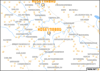
Ḩoseynābād (Ostān-e Kermānshāh, Iran)Ḩoseynābād is a town in the Ostān-e Kermānshāh region of Iran. An overview map of the region around Ḩoseynābād is displayed below.
regional and 3d topo map of Ḩoseynābād, Iran ::
Ḩoseynābād airports ::
The nearest airport is KSH - Bakhtaran Shahid Ashrafi Esfahani, located 44.7 km south east of Ḩoseynābād.
Other airports nearby include SDG - Sanandaj (84.7 km north), Nearby towns ::
Ja‘farābād (1.5km north) //
Gandombān-e Soflá (1.9km north east) //
Esmā‘īl Kal (1.9km north east) //
Gandombān-e ‘Olyā (1.9km north east) //
Khersābād (2.3km south) //
Choqā Kabūd-e ‘Olyā (2.2km south west) //
Choqā Elāhī (2.2km east) //
Deh A‘z̧am (2.7km north west) //
Sharafvand (2.9km south west) //
Dār Derafsh-e Seyyed Karīm (2.8km east) //
Dār Derafsh-e Moḩammad-e Amīn (2.8km east) //
Khersābād-e Bozorg (4.3km south) //
Khersābād-e Āqā Ja‘far (4.3km south) //
Qal‘eh Gelīneh-ye Soflá (4.5km south west) //
Qal‘eh Gelīneh-ye Vosţá (4.5km south west) //
Qal‘eh Gelīneh-ye ‘Olyā (4.6km south) //
Deh Mīraḩmad (4.7km north west) //
Khosrowābād-e Vasaţ (5.0km south east) //
Tappeh Lorī (5.3km north) //
Ḩājjīābād (4.5km east) //
Qez Qebrī-ye Doktor Ḩabīb (5.4km south) //
Lāchīn (5.5km north) //
Kolāhābād (5.5km north) //
Dār Derafsh-e Qal‘eh (4.9km south east) //
Qez Qebrī-ye Bahādor (5.7km south) //
Sorkheh Choqā (5.3km south west) //
Bānkalānī (5.3km north west) //
Tappeh Lorī (6.0km north) //
Shūr Bolāgh (5.9km north east) //
[all distances 'as the bird flies' and approximate]  Places with similar names to Ḩoseynābād, Iran ::
Disclaimer :: Information on this page comes without warranty of any kind |
||
|
Where is Ḩoseynābād? Elevation and coordinates ::
Latitude (lat): 34°31'13"N Longitude (lon): 46°43'11"E
Elevation (approx.): 1324m (map arrows pan, magnifying glasses zoom) |
||
|
Visiting Ḩoseynābād? Hotel/Accommodation ::
Book a hotel in Ḩoseynābād Travel Guide ::
Buy a travel guide for Iran rental cars ::
car rental offers GPS waypoint ::
download a GPX waypoint (PoI) of Ḩoseynābād for your GPS receiver
|
||