|
search place name
|
||
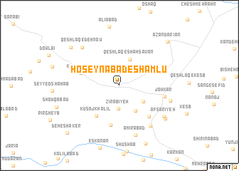
Ḩoseynābād-e Shāmlū (Hamadān, Iran)Ḩoseynābād-e Shāmlū is a town in the Hamadān region of Iran. An overview map of the region around Ḩoseynābād-e Shāmlū is displayed below.
regional and 3d topo map of Ḩoseynābād-e Shāmlū, Iran ::
Ḩoseynābād-e Shāmlū airports ::
The nearest airport is KSH - Bakhtaran Shahid Ashrafi Esfahani, located 134.8 km west of Ḩoseynābād-e Shāmlū.
Other airports nearby include SDG - Sanandaj (171.8 km north west), Nearby towns ::
Dehnow-e `Alīābād (2.9km north) //
Deh Now (2.8km north west) //
Zīr Ābīyeh (3.7km south) //
Qeshlāq-e Shāhsavan (4.3km north) //
Ḩasanābād-e Qoshbolāgh (4.0km south east) //
Zamānābād-e Moḩammadābād (4.5km south east) //
Kūsaj Khalīl (5.6km south west) //
Kūsaj Khalīl (6.2km south) //
Kheyrābād (5.4km west) //
Mobārakābād (6.2km south east) //
Jow Kār (6.1km east) //
Pīr Mīshān (7.5km south east) //
Amīrābād (8.1km south) //
Qeshlāq-e Dehnow (7.6km north west) //
‘Abbāsābād-e Jowkār (7.0km east) //
Afsarīyeh (7.5km south east) //
Golshīr (7.9km south east) //
Bādāmak (8.7km north west) //
Azandarīān (9.3km north east) //
Deh-e Shāker (10.1km south west) //
[all distances 'as the bird flies' and approximate] 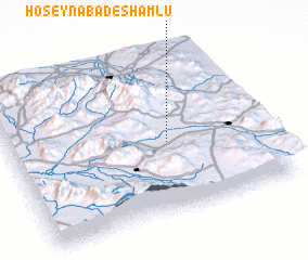 Places with similar names to Ḩoseynābād-e Shāmlū, Iran :: Disclaimer :: Information on this page comes without warranty of any kind |
||
|
Where is Ḩoseynābād-e Shāmlū? Elevation and coordinates ::
Latitude (lat): 34°26'48"N Longitude (lon): 48°37'8"E
Elevation (approx.): 1700m (map arrows pan, magnifying glasses zoom) |
||
|
Visiting Ḩoseynābād-e Shāmlū? Hotel/Accommodation ::
Book a hotel in Ḩoseynābād-e Shāmlū Travel Guide ::
Buy a travel guide for Iran rental cars ::
car rental offers GPS waypoint ::
download a GPX waypoint (PoI) of Ḩoseynābād-e Shāmlū for your GPS receiver
|
||