|
search place name
|
||
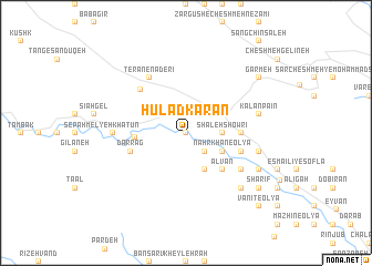
Ḩūlād Karān (Īlām, Iran)Ḩūlād Karān is a town in the Īlām region of Iran. An overview map of the region around Ḩūlād Karān is displayed below.
regional and 3d topo map of Ḩūlād Karān, Iran ::
Ḩūlād Karān airports ::
The nearest airport is KSH - Bakhtaran Shahid Ashrafi Esfahani, located 104.0 km north east of Ḩūlād Karān.
Other airports nearby include SDG - Sanandaj (168.1 km north east), Nearby towns ::
Kapneh Karān (0.0km north) //
Zarneh (1.9km north) //
Nahrkhān-e Soflá (2.4km south east) //
Sartang-e Soflá (2.4km north west) //
Shāleh Showrī (3.1km east) //
Ḩājjī Ḩāẕer (3.1km east) //
Emāmzādeh Ḩājjī Bakhtīār (4.0km south east) //
Nahrkhān-e ‘Olyā (3.6km south east) //
Zarneh Kūchek (3.6km north east) //
Kalān (3.6km south east) //
Dārvand-e Sartang (4.3km west) //
Balīyan (4.8km south east) //
Alvān (4.8km south east) //
Kalān Bālā (4.6km east) //
Darrag (5.0km west) //
Jūb Khān (5.0km east) //
‘Alamdār (5.0km east) //
Chehel Zarī (5.8km north west) //
Jūbgowhar-e Soflá (5.9km south east) //
Shūrābeh Malek (5.9km south east) //
Shūrābeh Khūrān (6.4km north west) //
Teran-e Nāderī (6.4km north west) //
Melyeh Khātūn (6.2km west) //
Sātīān (6.4km east) //
Kalān Pā'īn (6.4km east) //
Chafteh (7.2km south east) //
Jol Khvor (7.2km south east) //
Jūbgowhar-e ‘Olyā (7.2km south east) //
Sharīf (8.3km south east) //
[all distances 'as the bird flies' and approximate]  Places with similar names to Ḩūlād Karān, Iran :: Disclaimer :: Information on this page comes without warranty of any kind |
||
|
Where is Ḩūlād Karān? Elevation and coordinates ::
Latitude (lat): 33°54'0"N Longitude (lon): 46°10'0"E
Elevation (approx.): 1041m (map arrows pan, magnifying glasses zoom) |
||
|
Visiting Ḩūlād Karān? Hotel/Accommodation ::
Book a hotel in Ḩūlād Karān Travel Guide ::
Buy a travel guide for Iran rental cars ::
car rental offers GPS waypoint ::
download a GPX waypoint (PoI) of Ḩūlād Karān for your GPS receiver
|
||