|
search place name
|
||
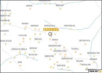
‘Īsáābād (Kermān, Iran)‘Īsáābād is a town in the Kermān region of Iran. An overview map of the region around ‘Īsáābād is displayed below.
regional and 3d topo map of ‘Īsáābād, Iran ::
‘Īsáābād airports ::
The nearest airport is KER - Kerman, located 82.9 km south of ‘Īsáābād.
Nearby towns ::
Dahaneh (0.9km south) //
Mehrūʼīyeh (1.0km north) //
Kamshīr (1.6km north east) //
Kankūʼīyeh (2.9km north) //
Khatm (2.8km south east) //
Fatḩābād (3.6km west) //
Bābshokūn (4.7km south) //
Sarāpardeh (4.8km south) //
Sarzeh (4.4km south west) //
Kahnūj (4.6km north west) //
Deh-e Now (5.2km west) //
Barfū'īyeh (5.2km west) //
Gebrān (5.7km south east) //
Kamshīr (5.8km north west) //
Dar Senjedū'īyeh (6.6km south) //
Darnadū'īyeh (7.0km south east) //
Sar Tangal (6.7km north east) //
Bābnarīān (6.7km west) //
Bābcheryūn (8.3km south) //
Bābsīfān (8.3km south) //
Bābbīdān (7.9km south east) //
Bondar (7.7km south west) //
Khonk (8.5km south east) //
Būtūyeh (9.6km south west) //
Band Borjī (10.8km south west) //
[all distances 'as the bird flies' and approximate] 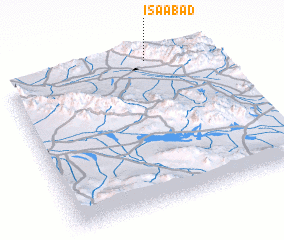 Places with similar names to ‘Īsáābād, Iran ::
Disclaimer :: Information on this page comes without warranty of any kind |
||
|
Where is ‘Īsáābād? Elevation and coordinates ::
Latitude (lat): 30°59'28"N Longitude (lon): 56°42'11"E
Elevation (approx.): 2021m (map arrows pan, magnifying glasses zoom) |
||
|
Visiting ‘Īsáābād? Hotel/Accommodation ::
Book a hotel in ‘Īsáābād Travel Guide ::
Buy a travel guide for Iran rental cars ::
car rental offers GPS waypoint ::
download a GPX waypoint (PoI) of ‘Īsáābād for your GPS receiver
|
||