|
search place name
|
||
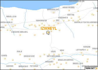
Īzī Kheyl (Iran)Īzī Kheyl is a town in Iran. An overview map of the region around Īzī Kheyl is displayed below.
regional and 3d topo map of Īzī Kheyl, Iran ::
Nearby towns ::
Estūnābād (1.6km north east) //
Banafsh Tappeh (1.8km west) //
Dashtī Kolā (3.7km north) //
Jafā Kandeh (3.7km north) //
Marang (4.0km north) //
Mazang (4.0km north) //
Dasht Kalāteh-ye Gharbī (4.0km north) //
Vaţanā' (3.7km north east) //
Now Kandeh (4.9km north west) //
Tel Nār (4.8km north west) //
Bīkārāyesh (4.5km west) //
Gaz (5.3km north east) //
Dasht Kalāteh-ye Sharqī (5.8km north) //
Tālūr (5.3km north west) //
Līvān-e Sharqī (5.8km north west) //
Chīnī Pārch (7.4km south) //
Chīn Pārch (7.4km south) //
Āghūz Darreh (7.6km south) //
Vevā (7.6km south) //
Līvān-e Gharbī (6.6km north west) //
Kūh Şaḩrā (7.1km north east) //
Kohneh Kolbād (7.0km north west) //
Kolkat (8.0km south) //
Dehī (8.1km south east) //
Bandar-e Gaz (8.7km north) //
Vezvār (8.6km south) //
Sar Maḩalleh (8.2km north east) //
Sarţāq (9.5km north east) //
[all distances 'as the bird flies' and approximate] 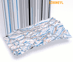 Places with similar names to Īzī Kheyl, Iran ::
Disclaimer :: Information on this page comes without warranty of any kind |
||
|
Where is Īzī Kheyl? Elevation and coordinates ::
Latitude (lat): 36°42'0"N Longitude (lon): 53°56'0"E
Elevation (approx.): 212m (map arrows pan, magnifying glasses zoom) |
||
|
Visiting Īzī Kheyl? Hotel/Accommodation ::
Book a hotel in Īzī Kheyl Travel Guide ::
Buy a travel guide for Iran rental cars ::
car rental offers GPS waypoint ::
download a GPX waypoint (PoI) of Īzī Kheyl for your GPS receiver
|
||