|
search place name
|
||
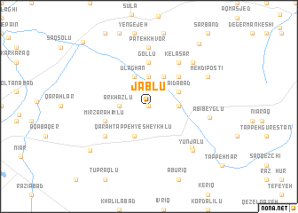
Jāblū (Iran)Jāblū is a town in Iran. An overview map of the region around Jāblū is displayed below.
regional and 3d topo map of Jāblū, Iran ::
Jāblū airports ::
The nearest airport is RAS - Rasht, located 144.2 km south east of Jāblū.
Nearby towns ::
Khalīfeh Qeshlāqī (0.0km north) //
Qareh Sū (2.9km east) //
Ārkhāzlū (2.9km west) //
Dovarjīn (3.7km north) //
Sa‘īdābād (3.4km north east) //
Qarah Tappeh-ye Sheykhlū (4.0km south) //
Qarah Chanāq (4.0km north) //
Ūlāghān (4.0km north) //
Karīm Kandī (4.7km north east) //
Gollū (5.6km north) //
Mīrzā Raḩīmlū (4.7km south west) //
Kelāsar (6.3km north east) //
Qarah Ḩasanlū (5.7km south west) //
Pateh Khvor (7.4km north) //
Maranī (6.7km south east) //
Ābī Beyglū (6.2km east) //
Dagermān Daraq (7.1km north east) //
Yūnjālū (7.1km south east) //
Mehdī Postī (6.9km north east) //
Āq Bolāgh-e Rostam Khān (8.0km south west) //
Naneh Karān (9.3km north east) //
Nūjadeh (10.4km north west) //
[all distances 'as the bird flies' and approximate] 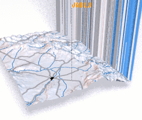 Places with similar names to Jāblū, Iran ::
Disclaimer :: Information on this page comes without warranty of any kind |
||
|
Where is Jāblū? Elevation and coordinates ::
Latitude (lat): 38°17'0"N Longitude (lon): 48°30'0"E
Elevation (approx.): 1319m (map arrows pan, magnifying glasses zoom) |
||
|
Visiting Jāblū? Hotel/Accommodation ::
Book a hotel in Jāblū Travel Guide ::
Buy a travel guide for Iran rental cars ::
car rental offers GPS waypoint ::
download a GPX waypoint (PoI) of Jāblū for your GPS receiver
|
||