|
search place name
|
||
Ja‘farābād-e Chamcham (Ostān-e Kermānshāh, Iran)Ja‘farābād-e Chamcham is a town in the Ostān-e Kermānshāh region of Iran. An overview map of the region around Ja‘farābād-e Chamcham is displayed below.
regional and 3d topo map of Ja‘farābād-e Chamcham, Iran ::

Ja‘farābād-e Chamcham airports ::
The nearest airport is KSH - Bakhtaran Shahid Ashrafi Esfahani, located 67.5 km south west of Ja‘farābād-e Chamcham.
Other airports nearby include SDG - Sanandaj (95.5 km north west), Nearby towns ::
Sharīfābād (2.4km north west) //
Cham Cham (2.4km north west) //
Tappeh Shārak (3.6km east) //
Kotar (4.8km north east) //
Kahtar (4.8km north east) //
Choqā Bālā-ye ‘Olyā (5.6km north) //
Sorkhelījeh (4.6km west) //
Kalbī Khānī (5.7km north) //
Choqā Bālā-ye Soflá (5.8km north) //
Cheshmeh Sangī (5.8km north) //
Kahrīz (5.8km north) //
Choqā-ye Bālā (5.8km north) //
Malekābād (4.9km west) //
Fārsīnaj (6.7km north west) //
Moḩammadābād (6.4km east) //
Zīveh (7.2km north east) //
‘Az̧īmābād (7.1km north east) //
Deh-e Elyās (8.7km north east) //
Fārsīnaj (8.3km north west) //
Ḩeşār (8.7km south east) //
Kal Godār (9.6km south west) //
[all distances 'as the bird flies' and approximate] 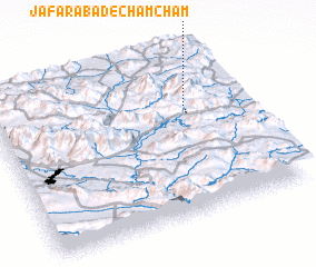 Places with similar names to Ja‘farābād-e Chamcham, Iran :: Disclaimer :: Information on this page comes without warranty of any kind |
||
|
Where is Ja‘farābād-e Chamcham? Elevation and coordinates ::
Latitude (lat): 34°40'0"N Longitude (lon): 47°47'0"E
Elevation (approx.): 1923m (map arrows pan, magnifying glasses zoom) |
||
|
Visiting Ja‘farābād-e Chamcham? Hotel/Accommodation ::
Book a hotel in Ja‘farābād-e Chamcham Travel Guide ::
Buy a travel guide for Iran rental cars ::
car rental offers GPS waypoint ::
download a GPX waypoint (PoI) of Ja‘farābād-e Chamcham for your GPS receiver
|
||