|
search place name
|
||
Jahān Moḩammad (Sīstān va Balūchestān, Iran)Jahān Moḩammad is a town in the Sīstān va Balūchestān region of Iran. An overview map of the region around Jahān Moḩammad is displayed below.
regional and 3d topo map of Jahān Moḩammad, Iran ::

Jahān Moḩammad airports ::
The nearest airport is ZAH - Zahedan Intl, located 161.4 km south west of Jahān Moḩammad.
Nearby towns ::
Khāleq Dād (1.1km south east) //
Palgī-ye Pā'īn (1.8km north west) //
Hāshem Zā'ī (2.6km north east) //
Fīrūzābād (3.0km north) //
Deh Now (3.0km north west) //
‘Alīābād (4.0km west) //
Deh-e Sūkhteh (4.2km north west) //
Lof (4.5km west) //
Sūkhteh (4.5km west) //
Qal‘eh-e Now (4.7km north east) //
Qal‘eh-ye Now (5.0km north east) //
Palgī-ye Ḩājjī Shahsavār (5.5km north) //
Palgī-ye Seyyed (5.6km north east) //
Palgī-ye Vosţá (5.8km north west) //
Deh-e Deh-e Ḩājjī Ḩoseyn (5.8km north west) //
Bandak (5.9km south west) //
Shīb Gūreh (6.4km north east) //
Navvāb (6.4km north east) //
Arbāb (7.0km north) //
Palgī-ye Khamar (7.1km north) //
Kal Kang (7.3km north) //
Dashtak (7.8km north west) //
Sheykh Langī (8.9km north) //
Chalest‘alī (8.9km north) //
Şafdar-e Darvīsh (8.9km north) //
Ḩoseynābad (8.9km north) //
Vāşelān (9.1km north) //
Deh-e Moḩammad ‘Alī Ḩeydar (9.1km north) //
Kaftāregī (8.8km north east) //
[all distances 'as the bird flies' and approximate] 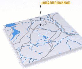 Places with similar names to Jahān Moḩammad, Iran :: Disclaimer :: Information on this page comes without warranty of any kind |
||
|
Where is Jahān Moḩammad? Elevation and coordinates ::
Latitude (lat): 30°48'13"N Longitude (lon): 61°35'39"E
Elevation (approx.): 484m (map arrows pan, magnifying glasses zoom) |
||
|
Visiting Jahān Moḩammad? Hotel/Accommodation ::
Book a hotel in Jahān Moḩammad Travel Guide ::
Buy a travel guide for Iran rental cars ::
car rental offers GPS waypoint ::
download a GPX waypoint (PoI) of Jahān Moḩammad for your GPS receiver
|
||