|
search place name
|
||
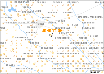
Jahān Tīgh (Sīstān va Balūchestān, Iran)Jahān Tīgh is a town in the Sīstān va Balūchestān region of Iran. An overview map of the region around Jahān Tīgh is displayed below.
regional and 3d topo map of Jahān Tīgh, Iran ::
Jahān Tīgh airports ::
The nearest airport is ZAH - Zahedan Intl, located 178.8 km south of Jahān Tīgh.
Nearby towns ::
Deh-e Ḩasan Yār Moḩammad (0.6km north) //
Deh-e Ḩeydarī (0.6km north) //
Deh-e Bāmerī (1.3km south) //
Deh-e Ḩājjī Şafar (1.9km south west) //
Golābād (2.4km north) //
Deh-e Karbalā'ī Gholāmreẕā (3.1km south) //
Deh-e Gholāmān (3.1km south) //
Karbāsak (3.0km south west) //
Deh-e Karbalā'ī Qorbān (3.4km south west) //
Deh-e Karbalāʼī Mūsá (3.3km south east) //
Deh-e Mūsá Kām Khān (3.6km south east) //
Zhāleh'ī (3.4km east) //
Deh-e Khān Jān-e Pīrī (3.5km east) //
Deh-eḨasan Pīrī (3.5km east) //
Sīāh Mard (4.3km north) //
Deh-e ‘Alī Ḩoseyn (4.1km north east) //
Deh-e Harātī (4.4km south west) //
Deh-e ‘Īsáābād (4.4km south west) //
Deh-e Ḩeydarī (5.0km south) //
Deh-e Varqeh (5.2km south) //
Deh-e Mollā Moḩammad (5.2km south) //
Deh-e Gol Mīr (5.2km south) //
Deh Now (5.3km south) //
Qāsemābād (4.6km west) //
Mīrzā Mūsá (5.3km south) //
Zābol (5.1km north west) //
Ās-e Qāẕī (5.9km south) //
Chahār Kharī (5.2km west) //
Bālā Sheykh (5.4km south west) //
[all distances 'as the bird flies' and approximate] 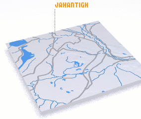 Places with similar names to Jahān Tīgh, Iran ::
// Jahān Tīgh (IR)
// Jahān Tīgh (IR)
Disclaimer :: Information on this page comes without warranty of any kind |
||
|
Where is Jahān Tīgh? Elevation and coordinates ::
Latitude (lat): 30°59'41"N Longitude (lon): 61°31'55"E
Elevation (approx.): 482m (map arrows pan, magnifying glasses zoom) |
||
|
Visiting Jahān Tīgh? Hotel/Accommodation ::
Book a hotel in Jahān Tīgh Travel Guide ::
Buy a travel guide for Iran rental cars ::
car rental offers GPS waypoint ::
download a GPX waypoint (PoI) of Jahān Tīgh for your GPS receiver
|
||