|
search place name
|
||
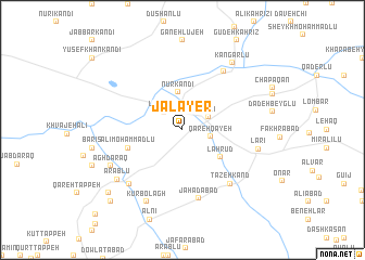
Jalāyer (Iran)Jalāyer is a town in Iran. An overview map of the region around Jalāyer is displayed below.
regional and 3d topo map of Jalāyer, Iran ::
Jalāyer airports ::
The nearest airport is TBZ - Tabriz Intl, located 139.7 km west of Jalāyer.
Other airports nearby include RAS - Rasht (211.2 km south east), Nearby towns ::
La‘l Ganj (2.4km north west) //
Qareh Qayeh (2.3km east) //
Adlī (2.5km north east) //
Nūr Kandī (3.9km north) //
Lāhrūd (4.2km south east) //
‘Alī Moḩammadlū (4.7km south west) //
Savāreh (4.7km south west) //
Jahādābād (7.2km south) //
Chang Darreh (6.9km north east) //
Tāzeh Kand (6.7km south east) //
Bījaq (7.0km south west) //
Lārī (6.5km east) //
Kūr Bolāgh (8.0km south) //
Āgh Daraq (6.9km south west) //
Gellar-e Moḩammadtaqī (6.9km south west) //
‘Arablū (7.3km south west) //
Kangarlū (8.0km north east) //
Dastgīr (8.8km south west) //
Beyḩaq (9.4km south west) //
[all distances 'as the bird flies' and approximate]  Places with similar names to Jalāyer, Iran ::
Disclaimer :: Information on this page comes without warranty of any kind |
||
|
Where is Jalāyer? Elevation and coordinates ::
Latitude (lat): 38°32'0"N Longitude (lon): 47°45'0"E
Elevation (approx.): 1037m (map arrows pan, magnifying glasses zoom) |
||
|
Visiting Jalāyer? Hotel/Accommodation ::
Book a hotel in Jalāyer Travel Guide ::
Buy a travel guide for Iran rental cars ::
car rental offers GPS waypoint ::
download a GPX waypoint (PoI) of Jalāyer for your GPS receiver
|
||