|
search place name
|
||
Jannatābād (Iran)Jannatābād is a town in Iran. An overview map of the region around Jannatābād is displayed below.
regional and 3d topo map of Jannatābād, Iran ::
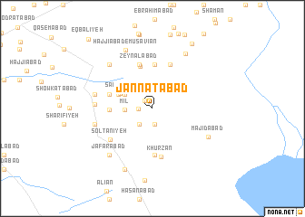
Nearby towns ::
Sharīfābād (1.2km north west) //
Kāmrānābād (1.4km west) //
Dahū (2.0km south) //
Kabūtar Khān (2.4km south west) //
Mīl (2.8km west) //
Seyyed Ābādū (3.3km north west) //
Sa‘īdābād (3.7km north west) //
Ma‘şūmābād (3.8km north west) //
‘Alīābād (4.3km west) //
Tavvakolābād (5.4km north) //
Kelā (5.4km north) //
Sa‘īdābād (4.6km west) //
Zeynālābād (5.6km north) //
Z̄eylābād (5.6km north) //
Forāt (5.7km south) //
Moḩammadīyeh (5.7km north) //
Khūrzān (6.0km south) //
Solţānīyeh (5.7km south west) //
Şāleḩābād (5.7km west) //
Majīdābād (6.0km west) //
Marḩamatābād (6.1km west) //
Ḩasanābād (6.9km north west) //
Mehdīābād (6.9km north west) //
Majīdābād (6.6km south east) //
Ja‘farābād (7.1km south west) //
Ḩājjīābād-e Mūsavīān (7.7km north) //
‘Abdīā (7.6km north east) //
Qāsemābād (8.1km south) //
Bahāābād (8.9km north east) //
[all distances 'as the bird flies' and approximate] 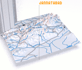 Places with similar names to Jannatābād, Iran ::
// Gendebta (ET)
// Jannatābād (IR)
// Jannatābād (IR)
// Jannatābād (IR)
// Jannatābād (IR)
// Jannatābād (IR)
// Jannatābād (IR)
// Jannatābād (IR)
// Jannatābād (IR)
// Jannatābād (IR)
Disclaimer :: Information on this page comes without warranty of any kind |
||
|
Where is Jannatābād? Elevation and coordinates ::
Latitude (lat): 36°0'5"N Longitude (lon): 54°20'51"E
Elevation (approx.): 1068m (map arrows pan, magnifying glasses zoom) |
||
|
Visiting Jannatābād? Hotel/Accommodation ::
Book a hotel in Jannatābād Travel Guide ::
Buy a travel guide for Iran rental cars ::
car rental offers GPS waypoint ::
download a GPX waypoint (PoI) of Jannatābād for your GPS receiver
|
||