|
search place name
|
||
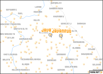
Javānrūd (Ostān-e Kermānshāh, Iran)Javānrūd is a town in the Ostān-e Kermānshāh region of Iran. An overview map of the region around Javānrūd is displayed below.
regional and 3d topo map of Javānrūd, Iran ::
Javānrūd airports ::
The nearest airport is SDG - Sanandaj, located 68.9 km north east of Javānrūd.
Other airports nearby include KSH - Bakhtaran Shahid Ashrafi Esfahani (79.8 km south east), Nearby towns ::
Qāderābād (1.5km west) //
Sarūkhān (1.9km south) //
Taḩrīkeh (2.1km south west) //
‘Alīābād-e Kohneh (2.4km south west) //
Ḩeydar (2.4km south west) //
‘Azīzābād (2.2km west) //
Tappeh Būr (3.0km south east) //
Khowsh Makān-e Bālā (3.3km south east) //
Şafīābād (3.1km east) //
Kānī Gol-e Soflá (3.7km south) //
Javānrūd (3.1km east) //
Ḩowẕ Kholeh (4.1km south) //
Torkeh-ye ‘Olyā (4.0km south) //
Torkeh-ye Tāzehābād (4.0km south) //
Māsendar (3.5km west) //
Kachalābād (3.9km north west) //
Kānī Gol-e ‘Olyā (4.6km south) //
Cheshmeh Mīrān (4.7km north east) //
Māsendar (4.3km south west) //
Tappeh Būr (5.0km south) //
Khowsh (4.6km south east) //
Bādkān (4.9km north west) //
Kūrī (5.5km north west) //
Kānī Sātīār (4.9km west) //
Kanī Gowhar (4.9km west) //
Torkeh-ye Soflá (5.8km south) //
Sūrān (5.3km south west) //
Cheshmeh Sefīd (6.3km south) //
Yārī (5.5km north west) //
[all distances 'as the bird flies' and approximate] 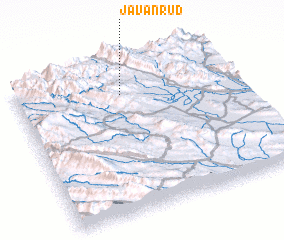 Places with similar names to Javānrūd, Iran ::
// Javānrūd (IR)
Disclaimer :: Information on this page comes without warranty of any kind |
||
|
Where is Javānrūd? Elevation and coordinates ::
Latitude (lat): 34°48'0"N Longitude (lon): 46°29'0"E
Elevation (approx.): 1333m (map arrows pan, magnifying glasses zoom) |
||
|
Visiting Javānrūd? Hotel/Accommodation ::
Book a hotel in Javānrūd Travel Guide ::
Buy a travel guide for Iran rental cars ::
car rental offers GPS waypoint ::
download a GPX waypoint (PoI) of Javānrūd for your GPS receiver
|
||