|
search place name
|
||
Jemrān (Khorāsān, Iran)Jemrān is a town in the Khorāsān region of Iran. An overview map of the region around Jemrān is displayed below.
regional and 3d topo map of Jemrān, Iran ::

Nearby towns ::
Qareh Kapanak (0.5km north east) //
Fereznī (0.7km north) //
Khātūnābād (0.7km south west) //
Rīzanī (1.1km north) //
Amīrābād (1.3km south) //
Ḩasanābād-e Sarjām (3.0km north) //
Bar Rūd (3.4km south west) //
Shūrāb-e Pā'īn (3.3km south east) //
‘Abdolmajīd (4.1km north east) //
Sar Ghāyeh (5.1km south west) //
Shūrāb-e Bālā (5.7km south) //
Cheram (5.8km south east) //
Sar Nīsh (5.4km west) //
Dāshkhāneh (6.6km north east) //
Āghā Malek (6.2km south east) //
Zamānābād (6.5km north west) //
Sahlābād (6.1km east) //
Gol Mey-e Bālā (6.3km east) //
Aḩmadābād-e Sarjām (7.3km south east) //
Māh Kārīz (7.7km south east) //
Sarjām (8.3km south east) //
Shūr Āb (7.8km east) //
Bāghcheh (10.5km north east) //
[all distances 'as the bird flies' and approximate] 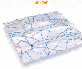 Places with similar names to Jemrān, Iran ::
Disclaimer :: Information on this page comes without warranty of any kind |
||
|
Where is Jemrān? Elevation and coordinates ::
Latitude (lat): 35°53'39"N Longitude (lon): 59°32'6"E
Elevation (approx.): 1383m (map arrows pan, magnifying glasses zoom) |
||
|
Visiting Jemrān? Hotel/Accommodation ::
Book a hotel in Jemrān Travel Guide ::
Buy a travel guide for Iran rental cars ::
car rental offers GPS waypoint ::
download a GPX waypoint (PoI) of Jemrān for your GPS receiver
|
||