|
search place name
|
||
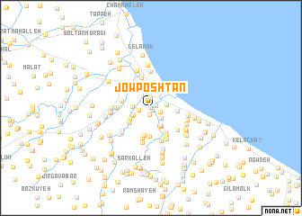
Jow Poshtān (Gīlān, Iran)Jow Poshtān is a town in the Gīlān region of Iran. An overview map of the region around Jow Poshtān is displayed below.
regional and 3d topo map of Jow Poshtān, Iran ::
Jow Poshtān airports ::
The nearest airport is RZR - Ramsar, located 42.3 km south east of Jow Poshtān.
Other airports nearby include RAS - Rasht (64.4 km west), THR - Teheran Mehrabad Intl (184.0 km south east), Nearby towns ::
Korjehposht (0.0km north) //
Sarmastān (0.0km north) //
Chavar Kalāyeh (0.3km south) //
Gīshākjān (0.6km north east) //
Kālmījān (0.8km south) //
Gol Darreh (1.1km south east) //
Rūdsar (1.3km north) //
Garmejān (1.3km west) //
Torshāyeh (1.7km south east) //
Daryāvārsar (1.6km east) //
Kolkā Sarā (1.8km west) //
Nāşer Sarā (2.0km south west) //
Tāzehābād (2.4km south east) //
Dīv Darreh (2.1km south west) //
Lasbū Maḩalleh (2.4km south) //
Bāzargān Maḩalleh (2.5km south east) //
Mordāb Bon (2.5km south west) //
Karafestān (2.9km south west) //
Sīāvān Maḩalleh (2.7km east) //
Mīān Poshteh (3.0km north west) //
Shīrāyeh (3.3km south east) //
Kol Maḩalleh (3.5km south) //
Shekarkash Maḩalleh (3.5km south) //
Māsāyeh (3.6km south east) //
Şaḩneh Sarā (3.0km west) //
Zīār Maḩalleh (3.7km south east) //
Lashkā Jān-e Soflá (3.8km south) //
Chāfjīr (3.9km north) //
Rowshan Ābsar (3.8km south east) //
[all distances 'as the bird flies' and approximate]  Places with similar names to Jow Poshtān, Iran :: Disclaimer :: Information on this page comes without warranty of any kind |
||
|
Where is Jow Poshtān? Elevation and coordinates ::
Latitude (lat): 37°7'28"N Longitude (lon): 50°17'12"E
Elevation (approx.): -20m (map arrows pan, magnifying glasses zoom) |
||
|
Visiting Jow Poshtān? Hotel/Accommodation ::
Book a hotel in Jow Poshtān Travel Guide ::
Buy a travel guide for Iran rental cars ::
car rental offers GPS waypoint ::
download a GPX waypoint (PoI) of Jow Poshtān for your GPS receiver
|
||