|
search place name
|
||
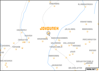
Jowqūneh (Iran)Jowqūneh is a town in Iran. An overview map of the region around Jowqūneh is displayed below.
regional and 3d topo map of Jowqūneh, Iran ::
Jowqūneh airports ::
The nearest airport is KER - Kerman, located 91.8 km east of Jowqūneh.
Other airports nearby include AZD - Yazd Shahid Sadooghi (265.4 km north west), Nearby towns ::
Torshāb-e Bālā (1.2km south west) //
Ḩasanābād (3.1km south west) //
‘Abbāsābād (3.5km south east) //
Shāhzādeh ‘Abbās (3.7km south east) //
Golī Namak (4.3km south east) //
Tangal-e Bālā (5.6km south) //
Bāgh Chenār (5.4km south east) //
Jalālābād (6.9km east) //
Rūdīneh (7.0km west) //
Golīlūn (7.1km west) //
Kalleh Shūr (7.4km south east) //
‘Abbāsābād (8.7km south) //
Deh-e Borzū (8.0km south east) //
Barīn-e Bālā (10.0km south east) //
Cheshmeh-ye Darāz (9.9km south east) //
Jīdūn (10.3km south east) //
[all distances 'as the bird flies' and approximate] 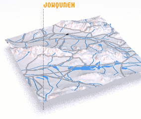 Places with similar names to Jowqūneh, Iran ::
Disclaimer :: Information on this page comes without warranty of any kind |
||
|
Where is Jowqūneh? Elevation and coordinates ::
Latitude (lat): 30°3'0"N Longitude (lon): 56°2'0"E
Elevation (approx.): 2350m (map arrows pan, magnifying glasses zoom) |
||
|
Visiting Jowqūneh? Hotel/Accommodation ::
Book a hotel in Jowqūneh Travel Guide ::
Buy a travel guide for Iran rental cars ::
car rental offers GPS waypoint ::
download a GPX waypoint (PoI) of Jowqūneh for your GPS receiver
|
||