|
search place name
|
||
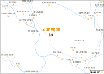
Jūneqān (Chahār Maḩāll va Bakhtīār, Iran)Jūneqān is a town in the Chahār Maḩāll va Bakhtīār region of Iran. An overview map of the region around Jūneqān is displayed below.
regional and 3d topo map of Jūneqān, Iran ::
Jūneqān airports ::
The nearest airport is QMJ - Masjed Soleiman Shahid Asyaee, located 135.2 km west of Jūneqān.
Other airports nearby include AWZ - Ahwaz (203.9 km south west), MRX - Bandar Mahshahr Mahshahr (229.7 km south west), Nearby towns ::
Āqāraḩīm (6.8km south) //
Asadābād (5.9km west) //
Bālāqalī (8.6km south) //
Parūj (7.9km south east) //
Cheqāhast (8.1km north west) //
As‘adīyeh (9.1km north west) //
Rāstāb (9.1km north west) //
Gūsheh (8.6km north west) //
Cholīcheh (10.6km north west) //
Amīrābād (10.8km south east) //
[all distances 'as the bird flies' and approximate] 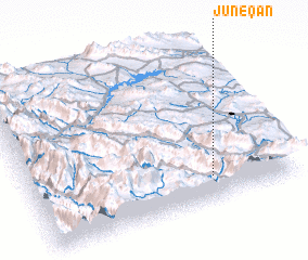 Places with similar names to Jūneqān, Iran ::
Disclaimer :: Information on this page comes without warranty of any kind |
||
|
Where is Jūneqān? Elevation and coordinates ::
Latitude (lat): 32°9'8"N Longitude (lon): 50°41'28"E
Elevation (approx.): 2041m (map arrows pan, magnifying glasses zoom) |
||
|
Visiting Jūneqān? Hotel/Accommodation ::
Book a hotel in Jūneqān Travel Guide ::
Buy a travel guide for Iran rental cars ::
car rental offers GPS waypoint ::
download a GPX waypoint (PoI) of Jūneqān for your GPS receiver
|
||