|
search place name
|
||
Kak Nān (Eşfahān, Iran)Kak Nān is a town in the Eşfahān region of Iran. An overview map of the region around Kak Nān is displayed below.
regional and 3d topo map of Kak Nān, Iran ::

Nearby towns ::
Jervekān (1.6km north east) //
Aresūn (1.6km west) //
Qarţemān (1.6km west) //
Horestān (1.8km north west) //
Āshenestān (1.9km east) //
Vāzīcheh (2.2km north east) //
Ādreyān (2.4km north west) //
Qal‘eh Amīrīyeh (2.3km west) //
Donbeh (2.6km south east) //
Kārlādān (2.4km east) //
Jūyābād (3.4km north) //
Andān (3.3km north west) //
Shahābābād (4.1km south) //
Dorcheh Pīāz (4.0km south) //
Āderīān (3.6km south west) //
Ja‘farābād (4.1km north) //
Fatḩābād (4.3km north) //
Darcheh-ye Kalmārān (4.4km south) //
Gūrtān (3.9km east) //
Joneyrān (4.2km north east) //
Kerm (4.2km north east) //
Khūzān (4.7km north west) //
Forūshān (4.5km north west) //
Sūdān (4.6km north east) //
Dastjerd (4.6km south east) //
Lādān (4.4km east) //
Darb-e Emāmzādeh (5.2km south) //
Esferīz (5.2km north) //
Tīrānchī (4.7km south west) //
[all distances 'as the bird flies' and approximate] 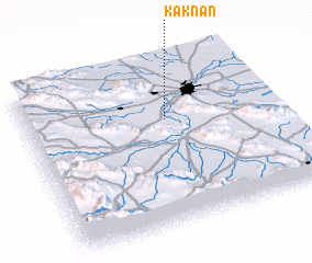 Places with similar names to Kak Nān, Iran ::
Disclaimer :: Information on this page comes without warranty of any kind |
||
|
Where is Kak Nān? Elevation and coordinates ::
Latitude (lat): 32°39'0"N Longitude (lon): 51°34'0"E
Elevation (approx.): 1591m (map arrows pan, magnifying glasses zoom) |
||
|
Visiting Kak Nān? Hotel/Accommodation ::
Book a hotel in Kak Nān Travel Guide ::
Buy a travel guide for Iran rental cars ::
car rental offers GPS waypoint ::
download a GPX waypoint (PoI) of Kak Nān for your GPS receiver
|
||