|
search place name
|
||
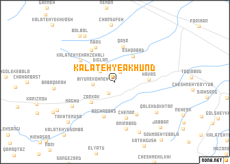
Kalāteh-ye Ākhūnd (Khorāsān, Iran)Kalāteh-ye Ākhūnd is a town in the Khorāsān region of Iran. An overview map of the region around Kalāteh-ye Ākhūnd is displayed below.
regional and 3d topo map of Kalāteh-ye Ākhūnd, Iran ::
Nearby towns ::
Cheshmeh-ye ‘Alī (1.7km north east) //
Z̄ehāb (2.0km south west) //
Alīābād-e Qarneh (2.6km north west) //
Bīyūn-e Kohneh (2.9km west) //
Dīglān (3.4km north west) //
Zarkak (4.5km south west) //
‘Eshqābād (4.9km north east) //
Havas (4.5km east) //
Qaşr (5.8km north) //
Bāgh ‘Abbās (5.8km south) //
Lūshāb (5.0km north east) //
Chenār (6.1km south) //
Kangak (6.0km south east) //
Separzād (6.1km north west) //
Nark (6.2km north west) //
Kalāteh-ye Ḩamzeh ‘Alī (5.7km north west) //
Amīrābād (7.8km south) //
Māghū (6.9km south west) //
Qal‘eh Dokhtar (7.4km south east) //
Cheshmeh Seyāmakī (8.5km north west) //
Şowma‘eh-ye Pā'īn (8.9km south) //
Bolbol (8.8km north west) //
Takht-e Mūsá (9.0km south west) //
Jabbār (9.6km south east) //
Kalāteh-ye Sombā (11.0km south west) //
[all distances 'as the bird flies' and approximate]  Places with similar names to Kalāteh-ye Ākhūnd, Iran ::
// Kalāteh-ye Ākhūnd (IR)
// Kalāteh-ye Ākhūnd (IR)
Disclaimer :: Information on this page comes without warranty of any kind |
||
|
Where is Kalāteh-ye Ākhūnd? Elevation and coordinates ::
Latitude (lat): 35°37'40"N Longitude (lon): 59°44'26"E
Elevation (approx.): 1707m (map arrows pan, magnifying glasses zoom) |
||
|
Visiting Kalāteh-ye Ākhūnd? Hotel/Accommodation ::
Book a hotel in Kalāteh-ye Ākhūnd Travel Guide ::
Buy a travel guide for Iran rental cars ::
car rental offers GPS waypoint ::
download a GPX waypoint (PoI) of Kalāteh-ye Ākhūnd for your GPS receiver
|
||