|
search place name
|
||
Kalāteh-ye Bālābām (Khorāsān, Iran)Kalāteh-ye Bālābām is a town in the Khorāsān region of Iran. An overview map of the region around Kalāteh-ye Bālābām is displayed below.
regional and 3d topo map of Kalāteh-ye Bālābām, Iran ::

Kalāteh-ye Bālābām airports ::
The nearest airport is ASB - Ashkhabad Ashgabat, located 227.5 km north west of Kalāteh-ye Bālābām.
Nearby towns ::
Marghash (0.5km north east) //
‘Aţţār (0.8km north west) //
Ḩoseynābād (1.7km south east) //
Dastgerdān (2.2km south west) //
Bāzeh Deh Now (2.1km west) //
Feyẕābād (3.1km north) //
Moḩammadābād-e Chaman (3.2km north) //
Āsīākol (2.7km east) //
Sangbar (3.4km north) //
Ghīās̄ābād-e Bālā (3.4km north east) //
Morghānān (4.0km north) //
Shahrābād (3.3km west) //
Ḩasanābād (4.1km south) //
Khādemabād (4.3km south) //
Sālārābād (4.6km south) //
‘Eyshābād (3.9km south west) //
Sākhtemān (3.9km west) //
Chāpār Qal‘eh (4.1km north west) //
Ghīās̄ābād-e Pā'īn (4.0km east) //
Kārīz-e Pāʼīn (4.6km north west) //
Qal‘eh-ye Olang (4.7km south east) //
Kaj Derakht (4.8km north west) //
Choghūkol (4.8km east) //
Kheyābān (4.9km west) //
Karīmābād (5.6km west) //
‘Alī Teymūr (6.4km north west) //
‘Alī Shādī (6.0km north west) //
Shotorak (6.9km north) //
Qal‘eh Now (7.2km south) //
[all distances 'as the bird flies' and approximate] 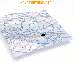 Places with similar names to Kalāteh-ye Bālābām, Iran :: Disclaimer :: Information on this page comes without warranty of any kind |
||
|
Where is Kalāteh-ye Bālābām? Elevation and coordinates ::
Latitude (lat): 36°16'13"N Longitude (lon): 59°45'41"E
Elevation (approx.): 922m (map arrows pan, magnifying glasses zoom) |
||
|
Visiting Kalāteh-ye Bālābām? Hotel/Accommodation ::
Book a hotel in Kalāteh-ye Bālābām Travel Guide ::
Buy a travel guide for Iran rental cars ::
car rental offers GPS waypoint ::
download a GPX waypoint (PoI) of Kalāteh-ye Bālābām for your GPS receiver
|
||