|
search place name
|
||
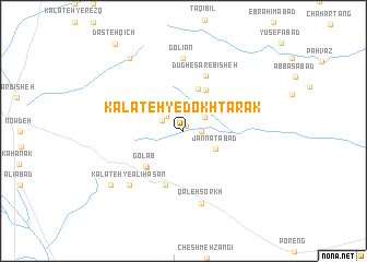
Kalāteh-ye Dokhtarak (Khorāsān, Iran)Kalāteh-ye Dokhtarak is a town in the Khorāsān region of Iran. An overview map of the region around Kalāteh-ye Dokhtarak is displayed below.
regional and 3d topo map of Kalāteh-ye Dokhtarak, Iran ::
Kalāteh-ye Dokhtarak airports ::
The nearest airport is XBJ - Birjand, located 75.3 km north west of Kalāteh-ye Dokhtarak.
Nearby towns ::
Gondakān (0.6km north east) //
‘Alamābād (1.6km east) //
Sargazān-e Bālā (2.0km north west) //
Ḩasan Kolangī (2.1km north west) //
Gazān-e Pā'īn (2.2km north west) //
Khārān (2.3km north east) //
Jannatābād (3.4km south east) //
Shūshk-e Pā'īn (4.5km north) //
Shūshk-e Bālā (4.6km north east) //
Bahluri (4.8km south west) //
Golāb (4.8km south west) //
Khalīlān (5.8km south) //
Dūgh-e Sar-e Bīsheh (6.0km north) //
Golestān (7.4km north) //
Golīān (7.4km north) //
Qal‘eh Sorkh (7.6km south) //
Kalāteh-ye ‘Alī Ḩasan (7.3km south west) //
Chāh-e Mīr Shāin (8.8km north west) //
Chāh-e Moḩammad Jamāl (8.4km south west) //
Dasteh Qīch (10.6km north west) //
[all distances 'as the bird flies' and approximate] 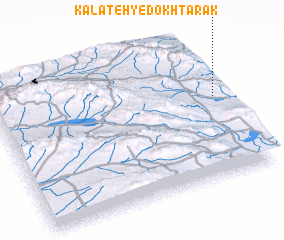 Places with similar names to Kalāteh-ye Dokhtarak, Iran :: Disclaimer :: Information on this page comes without warranty of any kind |
||
|
Where is Kalāteh-ye Dokhtarak? Elevation and coordinates ::
Latitude (lat): 32°34'0"N Longitude (lon): 59°58'0"E
Elevation (approx.): 1787m (map arrows pan, magnifying glasses zoom) |
||
|
Visiting Kalāteh-ye Dokhtarak? Hotel/Accommodation ::
Book a hotel in Kalāteh-ye Dokhtarak Travel Guide ::
Buy a travel guide for Iran rental cars ::
car rental offers GPS waypoint ::
download a GPX waypoint (PoI) of Kalāteh-ye Dokhtarak for your GPS receiver
|
||