|
search place name
|
||
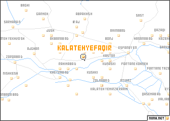
Kalāteh-ye Faqīr (Khorāsān, Iran)Kalāteh-ye Faqīr is a town in the Khorāsān region of Iran. An overview map of the region around Kalāteh-ye Faqīr is displayed below.
regional and 3d topo map of Kalāteh-ye Faqīr, Iran ::
Kalāteh-ye Faqīr airports ::
The nearest airport is ASB - Ashkhabad Ashgabat, located 131.9 km north east of Kalāteh-ye Faqīr.
Nearby towns ::
Farīmān (1.9km north) //
Palang Darreh (1.9km north) //
Kalāteh-ye Sādāt (2.4km north east) //
Dezh Asbī (2.4km south west) //
Sīnān (3.0km east) //
Ḩeşārī (3.5km north east) //
Kūshkī (4.0km south) //
Raḩīmābād (3.5km south west) //
Fīrūzābād (4.7km south east) //
Chehel Ḩeşār (5.0km south west) //
Kastān (4.4km east) //
Bazanaj (4.8km north east) //
Dūrī (4.8km north west) //
Seyyedābād (4.8km south west) //
Kūnaskī (4.8km south east) //
Marāgheh (5.8km north) //
Āb Bakhsh (6.2km north) //
Jūshaqān (6.2km south east) //
Borj (5.8km north east) //
Z̧olmābād (6.3km south east) //
Akbarābād (5.8km north west) //
Kheyrābād (5.8km south west) //
Naqīābād (6.3km south west) //
Īraj (7.6km north) //
Ḩoseynābād-e Kordhā (7.6km south) //
Kesreq (7.0km north west) //
Amīnābād (8.1km north east) //
Kalāteh-ye Mīrzā Raḩīm (8.6km south east) //
Jūsh (8.1km north west) //
[all distances 'as the bird flies' and approximate] 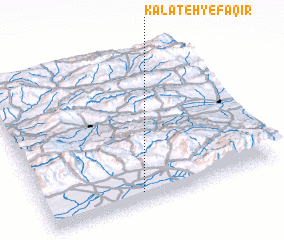 Places with similar names to Kalāteh-ye Faqīr, Iran :: Disclaimer :: Information on this page comes without warranty of any kind |
||
|
Where is Kalāteh-ye Faqīr? Elevation and coordinates ::
Latitude (lat): 37°4'0"N Longitude (lon): 57°25'0"E
Elevation (approx.): 1163m (map arrows pan, magnifying glasses zoom) |
||
|
Visiting Kalāteh-ye Faqīr? Hotel/Accommodation ::
Book a hotel in Kalāteh-ye Faqīr Travel Guide ::
Buy a travel guide for Iran rental cars ::
car rental offers GPS waypoint ::
download a GPX waypoint (PoI) of Kalāteh-ye Faqīr for your GPS receiver
|
||