|
search place name
|
||
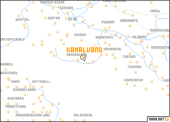
Kamālvand (Hamadān, Iran)Kamālvand is a town in the Hamadān region of Iran. An overview map of the region around Kamālvand is displayed below.
regional and 3d topo map of Kamālvand, Iran ::
Kamālvand airports ::
The nearest airport is KSH - Bakhtaran Shahid Ashrafi Esfahani, located 86.3 km west of Kamālvand.
Other airports nearby include SDG - Sanandaj (149.4 km north west), Nearby towns ::
Dowlatābād (0.6km south east) //
Maḩmūdvand (1.4km west) //
Raḩmatābād (1.4km east) //
Fārsbān (3.2km north east) //
‘Abbāsābād (3.8km north east) //
Gīvahkī (4.7km north) //
Zarrīn Bāgh (4.2km east) //
Shīr Āvand (5.5km north east) //
Sar Darreh (5.5km north west) //
Ja‘farābād (5.2km east) //
Razīnī (5.7km north east) //
Aznahrī (5.5km east) //
Balūţ Kūh (6.4km north west) //
Amīrābād (5.8km west) //
Gonbad Kabūd (5.8km east) //
Qal‘eh-ye ‘Alī Khān (6.8km north west) //
Seh Korān (6.5km north west) //
Ḩoseynābād-e Serkān (7.4km north) //
Tappeh ‘Alī (6.5km west) //
Hādīābād (7.5km north east) //
Sharīfābād (8.1km north) //
Qīlāb (8.3km north) //
Aḩmadābād-e ‘Olyā (8.0km north east) //
Akbarābād (8.8km north) //
Aḩmadābād-e Soflá (8.1km north west) //
Mūsáābād (8.1km north east) //
Rūdbārī (8.6km north east) //
Shahrak (8.2km north east) //
Aḩmadābād-e ‘Olya (8.7km north west) //
[all distances 'as the bird flies' and approximate] 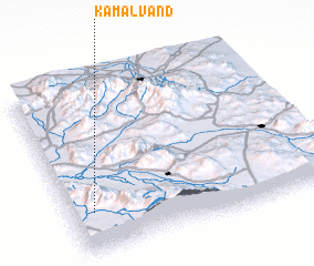 Places with similar names to Kamālvand, Iran ::
// Kamālvand (IR)
Disclaimer :: Information on this page comes without warranty of any kind |
||
|
Where is Kamālvand? Elevation and coordinates ::
Latitude (lat): 34°14'1"N Longitude (lon): 48°5'10"E
Elevation (approx.): 1647m (map arrows pan, magnifying glasses zoom) |
||
|
Visiting Kamālvand? Hotel/Accommodation ::
Book a hotel in Kamālvand Travel Guide ::
Buy a travel guide for Iran rental cars ::
car rental offers GPS waypoint ::
download a GPX waypoint (PoI) of Kamālvand for your GPS receiver
|
||