|
search place name
|
||
Kamar Mārī (Kermān, Iran)Kamar Mārī is a town in the Kermān region of Iran. An overview map of the region around Kamar Mārī is displayed below.
regional and 3d topo map of Kamar Mārī, Iran ::

Kamar Mārī airports ::
The nearest airport is KER - Kerman, located 168.7 km east of Kamar Mārī.
Other airports nearby include AZD - Yazd Shahid Sadooghi (187.1 km north west), Nearby towns ::
Kūk Sorkh (1.5km north) //
Khāleng (2.7km south) //
Bīdū'īyeh (2.8km south) //
Gozgestān (2.7km south east) //
Kam Kūh (3.1km north) //
Behzādān (3.3km north) //
Mīdūk (3.7km north) //
Deh Now (3.9km north east) //
Bandevān (4.3km south) //
Torsh Kūh (4.0km north east) //
Pāres Kūh (4.4km north) //
Tangāleh-ye ‘Olyā (4.3km north east) //
Bon Tūt (4.5km north) //
Jīzom (5.0km north) //
Barākū'īyeh (5.0km south west) //
‘Abdollāhābād (4.7km east) //
Kameshkū'īyeh (5.0km south west) //
Kūy-e Lāy-e ‘Abdollāhābād (5.0km east) //
Ḩūrīān (6.0km north) //
Sorūshk (6.1km south) //
Barākū'īyeh (5.8km south west) //
Dāvūdābād (6.1km south) //
Rendū (6.1km south west) //
Kūy-e Lāy-e Zīrūmesīnān (5.9km south east) //
Lāy Ţalā (6.2km north west) //
Senjedkū'īyeh (6.6km south) //
Kūh Qal‘eh Lāţalā (5.8km west) //
Behnū'īyeh (6.7km south west) //
Behnū'īyeh (6.7km south west) //
[all distances 'as the bird flies' and approximate] 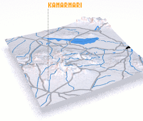 Places with similar names to Kamar Mārī, Iran ::
Disclaimer :: Information on this page comes without warranty of any kind |
||
|
Where is Kamar Mārī? Elevation and coordinates ::
Latitude (lat): 30°25'3"N Longitude (lon): 55°12'14"E
Elevation (approx.): 2571m (map arrows pan, magnifying glasses zoom) |
||
|
Visiting Kamar Mārī? Hotel/Accommodation ::
Book a hotel in Kamar Mārī Travel Guide ::
Buy a travel guide for Iran rental cars ::
car rental offers GPS waypoint ::
download a GPX waypoint (PoI) of Kamar Mārī for your GPS receiver
|
||