|
search place name
|
||
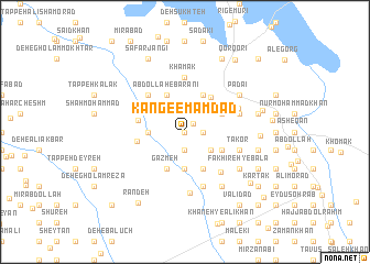
Kang-e Emām Dād (Sīstān va Balūchestān, Iran)Kang-e Emām Dād is a town in the Sīstān va Balūchestān region of Iran. An overview map of the region around Kang-e Emām Dād is displayed below.
regional and 3d topo map of Kang-e Emām Dād, Iran ::
Kang-e Emām Dād airports ::
The nearest airport is ZAH - Zahedan Intl, located 204.7 km south of Kang-e Emām Dād.
Nearby towns ::
Kondel (0.0km north) //
Borj-e Yūsef (1.1km north east) //
Zīāratgāh-e Shāh Esmā‘īl (1.6km east) //
Kang-e Mollā ‘Abdollāh (1.9km south) //
Deh-e Gīāmā (2.9km south east) //
Deh Now (3.7km south) //
Solţān (3.2km west) //
Rasūl Khān (4.0km south east) //
Shāh Beyk (4.0km north east) //
Gazmeh (4.0km south west) //
Gol-e Mīr Karam (3.7km south east) //
Golzār-e Nowrūz (3.7km south east) //
Shahrakī (3.7km north east) //
‘Abdollāh-e Bārānī (4.0km north west) //
Palgī (4.2km north east) //
Akbarābād (4.2km west) //
Khāneh-ye Mollā Moḩammad Khān (4.2km west) //
Dowlatābād (4.9km north west) //
Mollā Goljān (5.1km south east) //
Khāmak (5.6km north) //
Yūsef-e Eslām (5.8km south) //
Gol Moḩammad-e Shīr Moḩammad (5.8km south) //
Khāneh-ye Madad (5.8km south) //
Takor (5.1km east) //
Namrūdī (5.1km east) //
‘Alī Khān-e Zamān (5.1km east) //
Shīrdel (5.1km east) //
Borj-e Mīrgol (5.2km north east) //
Shandūl (6.3km south) //
[all distances 'as the bird flies' and approximate] 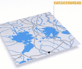 Places with similar names to Kang-e Emām Dād, Iran :: Disclaimer :: Information on this page comes without warranty of any kind |
||
|
Where is Kang-e Emām Dād? Elevation and coordinates ::
Latitude (lat): 31°12'0"N Longitude (lon): 61°40'0"E
Elevation (approx.): 480m (map arrows pan, magnifying glasses zoom) |
||
|
Visiting Kang-e Emām Dād? Hotel/Accommodation ::
Book a hotel in Kang-e Emām Dād Travel Guide ::
Buy a travel guide for Iran rental cars ::
car rental offers GPS waypoint ::
download a GPX waypoint (PoI) of Kang-e Emām Dād for your GPS receiver
|
||