|
search place name
|
||
Kapar Torāb (Ostān-e Kohgīlūyeh va Būyer Aḩmad, Iran)Kapar Torāb is a town in the Ostān-e Kohgīlūyeh va Būyer Aḩmad region of Iran. An overview map of the region around Kapar Torāb is displayed below.
regional and 3d topo map of Kapar Torāb, Iran ::

Kapar Torāb airports ::
The nearest airport is MRX - Bandar Mahshahr Mahshahr, located 133.2 km west of Kapar Torāb.
Other airports nearby include QMJ - Masjed Soleiman Shahid Asyaee (162.9 km north west), AWZ - Ahwaz (168.1 km west), Nearby towns ::
Kohnāb-e Pā'īn (0.0km north) //
Torāb-e Bālā (1.1km north) //
Qal‘eh-ye Tīrū (1.6km east) //
Seh Godār-e Cham-e Āftāb (1.9km north) //
Kohnāb-e Bālā (1.9km north) //
Tagargī (2.4km south west) //
Borm-e Shīr (3.7km south) //
Torāb-e Pā'īn (3.2km east) //
Āb Korī (3.5km south west) //
Chenda (5.4km north) //
Beheshtābād (4.8km west) //
Līr-e Kūchek (5.3km south west) //
Landeh (5.3km north west) //
Kūh-e Rāk (5.8km south) //
Līr-e Bozorg (5.8km south) //
Āb Zargeh (5.5km west) //
Eydanak (5.5km west) //
Meydeh (6.3km north) //
Deh Garū (6.3km north west) //
Takht Derāz (5.7km west) //
Līrlak (6.0km north east) //
Darreh Tol (7.0km north) //
Tang-e Āb-e Kerātūl (6.4km east) //
Chahār Gowd (6.4km west) //
Deh Show (7.5km north) //
Pā'īn Kūh Pāt (6.5km east) //
Dehtal (7.6km north) //
Sar Āsīāb (6.6km west) //
Deh Pahn (7.3km north west) //
[all distances 'as the bird flies' and approximate] 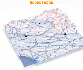 Places with similar names to Kapar Torāb, Iran :: Disclaimer :: Information on this page comes without warranty of any kind |
||
|
Where is Kapar Torāb? Elevation and coordinates ::
Latitude (lat): 30°57'0"N Longitude (lon): 50°28'0"E
Elevation (approx.): 690m (map arrows pan, magnifying glasses zoom) |
||
|
Visiting Kapar Torāb? Hotel/Accommodation ::
Book a hotel in Kapar Torāb Travel Guide ::
Buy a travel guide for Iran rental cars ::
car rental offers GPS waypoint ::
download a GPX waypoint (PoI) of Kapar Torāb for your GPS receiver
|
||