|
search place name
|
||
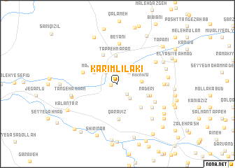
Karīm Līlakī (Ostān-e Kermānshāh, Iran)Karīm Līlakī is a town in the Ostān-e Kermānshāh region of Iran. An overview map of the region around Karīm Līlakī is displayed below.
regional and 3d topo map of Karīm Līlakī, Iran ::
Karīm Līlakī airports ::
The nearest airport is KSH - Bakhtaran Shahid Ashrafi Esfahani, located 128.4 km east of Karīm Līlakī.
Other airports nearby include SDG - Sanandaj (136.1 km north east), Nearby towns ::
Tang-e Ḩammām (0.9km west) //
Qolkhānchek (2.0km south east) //
Jāberī (2.4km north west) //
Band Kalāleh (2.4km north east) //
Pāpalī (2.4km north east) //
Boneh Dastak (2.8km south east) //
Akrābād (2.9km north west) //
Mīrmīrū (3.2km east) //
Majrūlān (3.6km north west) //
Tappeh Mārān (4.6km north) //
Bargbārān (5.0km north) //
Nāderī (4.4km south east) //
Qal‘eh-ye Rashīd Āqā (4.8km south east) //
Emām Ḩasan (4.7km south east) //
Qarāvīz (5.6km south) //
Khiḑr Badr (4.9km west) //
Beyānī (6.5km north) //
Gol Khāţer (5.7km south east) //
Dastak (5.9km south east) //
Anūshirvān (6.1km north east) //
Mojtame‘-e Maskūnī-ye Kū'īk (6.1km east) //
Bābā Hādī (6.4km west) //
Tang-e Ḩammām (6.4km west) //
Dār Khvor (6.4km west) //
Tappeh Rīsh Dar-e Veys (7.2km south east) //
Zarrīn Jūb (7.2km south east) //
Kūyakī Majīd (6.6km east) //
Qal‘eh Badrī (6.9km north east) //
Kū'īk-e Ḩasan (6.8km east) //
[all distances 'as the bird flies' and approximate] 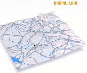 Places with similar names to Karīm Līlakī, Iran :: Disclaimer :: Information on this page comes without warranty of any kind |
||
|
Where is Karīm Līlakī? Elevation and coordinates ::
Latitude (lat): 34°33'0"N Longitude (lon): 45°47'0"E
Elevation (approx.): 486m (map arrows pan, magnifying glasses zoom) |
||
|
Visiting Karīm Līlakī? Hotel/Accommodation ::
Book a hotel in Karīm Līlakī Travel Guide ::
Buy a travel guide for Iran rental cars ::
car rental offers GPS waypoint ::
download a GPX waypoint (PoI) of Karīm Līlakī for your GPS receiver
|
||