|
search place name
|
||
Kāshmar (Khorāsān, Iran)Kāshmar is a town in the Khorāsān region of Iran. An overview map of the region around Kāshmar is displayed below.
regional and 3d topo map of Kāshmar, Iran ::
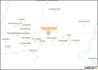
Nearby towns ::
Forūtaqeh (2.4km south) //
Fadāfen (3.7km south east) //
Qūzhd (3.8km south west) //
Feyz̄īābād (4.6km south west) //
Rezqābād (4.5km east) //
Feyẕīābād (4.9km south west) //
Moghān (4.9km west) //
Torbeqān (5.4km south east) //
Fark (6.3km east) //
Kāzhghūneh (6.9km east) //
‘Ārefābād (7.3km south east) //
Faraḩābād (7.2km east) //
Kasrīneh (7.5km north west) //
Momrābād (7.5km west) //
Talābād (8.5km south west) //
Esḩāqābād (9.0km south west) //
[all distances 'as the bird flies' and approximate] 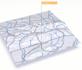 Places with similar names to Kāshmar, Iran ::
// Kashmar (IQ)
// Kachmary (UA)
// Kochmary (UA)
// Kochemary (RU)
// Kashmir (US)
// Cashmere (US)
// Gochhāmāra (BD)
// Kāshīmāri (BD)
// Kuchiāmora (BD)
// Kuchiāmora (BD)
Disclaimer :: Information on this page comes without warranty of any kind |
||
|
Where is Kāshmar? Elevation and coordinates ::
Latitude (lat): 35°14'11"N Longitude (lon): 58°28'55"E
Elevation (approx.): 1053m (map arrows pan, magnifying glasses zoom) |
||
|
Visiting Kāshmar? Hotel/Accommodation ::
Book a hotel in Kāshmar Travel Guide ::
Buy a travel guide for Iran rental cars ::
car rental offers GPS waypoint ::
download a GPX waypoint (PoI) of Kāshmar for your GPS receiver
|
||