|
search place name
|
||
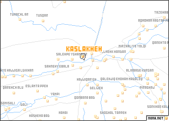
Kaslakheh (Golestān, Iran)Kaslakheh is a town in the Golestān region of Iran. An overview map of the region around Kaslakheh is displayed below.
regional and 3d topo map of Kaslakheh, Iran ::
Nearby towns ::
Āq Tekeh Khān (1.7km south west) //
Āq Qal‘eh (1.5km east) //
Kalābād (2.0km north east) //
Şāleḩ Peyghambar (2.2km west) //
Do Gonjī (2.3km south west) //
Ţa‘neh (2.8km south east) //
Qān Qermeh (3.5km east) //
Moḩammad Āleq (3.8km east) //
Ḩājjī Qareh (5.4km south) //
Āq Qabr (4.7km west) //
Shūr Ḩayāt (5.8km south east) //
Şaḩneh-ye Bālā (5.3km south west) //
Yolmeh Khandān (5.2km east) //
Şaḩneh-ye Pā'īn (6.3km south west) //
Delījeh (7.5km south) //
Qeshlāq-e Yolqī (6.7km east) //
Qal‘eh Jīq-e Moḩammad Āleq (8.6km south east) //
Qūshjānābād (9.0km south east) //
Yāmpī (9.9km south west) //
Now Deh-e Ḩājjī Sharīf (9.8km south east) //
Fūjerd (9.8km south east) //
Khūjeh Tūp (9.8km south east) //
Qaranjīk-e Gūgjelī (10.8km south west) //
[all distances 'as the bird flies' and approximate] 
Disclaimer :: Information on this page comes without warranty of any kind |
||
|
Where is Kaslakheh? Elevation and coordinates ::
Latitude (lat): 37°0'52"N Longitude (lon): 54°26'27"E
Elevation (approx.): -20m (map arrows pan, magnifying glasses zoom) |
||
|
Visiting Kaslakheh? Hotel/Accommodation ::
Book a hotel in Kaslakheh Travel Guide ::
Buy a travel guide for Iran rental cars ::
car rental offers GPS waypoint ::
download a GPX waypoint (PoI) of Kaslakheh for your GPS receiver
|
||