|
search place name
|
||
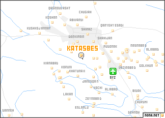
Katas Bes (Fārs, Iran)Katas Bes is a town in the Fārs region of Iran. An overview map of the region around Katas Bes is displayed below.
regional and 3d topo map of Katas Bes, Iran ::
Katas Bes airports ::
The nearest airport is SYZ - Shiraz Shahid Dastghaib Intl, located 6.7 km south east of Katas Bes.
Other airports nearby include BUZ - Bushehr (178.3 km west), Nearby towns ::
Kūshk-e Meydān (2.2km east) //
‘Ādelābād (2.7km north west) //
Kūtāhī (2.9km north west) //
Qebleh (3.2km north) //
Deh Pīāleh (2.9km east) //
Mo‘ezzābād (3.5km south east) //
Derkī Bālā (3.8km north west) //
Khātūnak (4.0km south) //
Derkī Pā'īn (4.1km north) //
Sheykh ‘Alī Chūpān (3.9km south east) //
Korūnī (4.2km south west) //
Khātūn (4.5km north east) //
Solţānābād (4.6km south east) //
Forūdgāh (4.2km east) //
Shāh Qolī Beygī (5.0km north west) //
Amīrī (5.2km south east) //
Shīrāz (5.7km north) //
Maḩmūdābād-e Pīr Banow (5.3km south west) //
Dasht-e Chenār (5.3km east) //
Shāhījān (5.8km north east) //
Jamālābād (6.0km south west) //
Jaresqān (6.5km south) //
Pūdonak (5.9km east) //
Pīr Yenū (6.3km south west) //
Maḩmūdābād (6.8km south west) //
Kīānābād (6.4km west) //
Shāpūr Jān (6.7km south west) //
Kafrī (7.4km south west) //
Abīvardī (7.8km north) //
[all distances 'as the bird flies' and approximate] 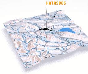 Places with similar names to Katas Bes, Iran ::
// Kateh Sabz (IR)
Disclaimer :: Information on this page comes without warranty of any kind |
||
|
Where is Katas Bes? Elevation and coordinates ::
Latitude (lat): 29°33'53"N Longitude (lon): 52°31'39"E
Elevation (approx.): 1520m (map arrows pan, magnifying glasses zoom) |
||
|
Visiting Katas Bes? Hotel/Accommodation ::
Book a hotel in Katas Bes Travel Guide ::
Buy a travel guide for Iran rental cars ::
car rental offers GPS waypoint ::
download a GPX waypoint (PoI) of Katas Bes for your GPS receiver
|
||