|
search place name
|
||
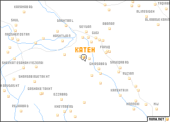
Kateh (Fārs, Iran)Kateh is a town in the Fārs region of Iran. An overview map of the region around Kateh is displayed below.
regional and 3d topo map of Kateh, Iran ::
Kateh airports ::
The nearest airport is SYZ - Shiraz Shahid Dastghaib Intl, located 60.5 km south west of Kateh.
Other airports nearby include AZD - Yazd Shahid Sadooghi (248.7 km north east), Nearby towns ::
Boz Mīān (1.0km north east) //
Anjīreh (1.3km north west) //
Ḩasanābād-e Tolkamīn (2.1km north) //
Ghīās̄ābād (3.1km south east) //
Rāhnūyeh (3.4km south east) //
Bāgh Būdarh (4.0km south east) //
Esma‘īlābād (4.3km north) //
Ḩasanābād (4.1km west) //
Fārūq (4.4km north east) //
‘Alīābād (5.2km north) //
Hāshemābād-e Gūrī (5.3km north) //
Myak (4.8km north east) //
Dīvār (5.4km north east) //
Gūgī (5.5km north) //
Ahrak (5.1km north east) //
‘Abbāsābād (5.7km south east) //
Āb Anār (5.7km north east) //
Seydān (6.4km north) //
Hashtījān (6.1km north west) //
Morādābād (6.9km east) //
Şādeqābād (6.9km east) //
Dasht Bāl (8.6km north west) //
Khalaf Ţāhūneh (8.4km north west) //
Āb Anār (8.5km north east) //
‘Ezzābād (9.6km south west) //
Kareh Ţāvī (10.1km south east) //
[all distances 'as the bird flies' and approximate] 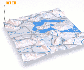 Places with similar names to Kateh, Iran ::
Disclaimer :: Information on this page comes without warranty of any kind |
||
|
Where is Kateh? Elevation and coordinates ::
Latitude (lat): 29°56'50"N Longitude (lon): 53°0'19"E
Elevation (approx.): 1642m (map arrows pan, magnifying glasses zoom) |
||
|
Visiting Kateh? Hotel/Accommodation ::
Book a hotel in Kateh Travel Guide ::
Buy a travel guide for Iran rental cars ::
car rental offers GPS waypoint ::
download a GPX waypoint (PoI) of Kateh for your GPS receiver
|
||